| PalestineRemembered | About Us | Oral History | العربية | |
| Pictures | Zionist FAQs | Haavara | Maps | |
| Search |
| Camps |
| Districts |
| Acre |
| Baysan |
| Beersheba |
| Bethlehem |
| Gaza |
| Haifa |
| Hebron |
| Jaffa |
| Jericho |
| Jerusalem |
| Jinin |
| Nablus |
| Nazareth |
| Ramallah |
| al-Ramla |
| Safad |
| Tiberias |
| Tulkarm |
| Donate |
| Contact |
| Profile |
| Videos |
Welcome To Dayr al-Asad - دير الاسد (דיר אל-אסד)
|
District of Acre
Occupied days ago |
العربية Google Earth |
 |
Gallery (64) |
- Statistics & Facts
-
Before & After

- Satellite View
- Articles 1
- Pictures 64
- Oral History 10
- Members 16
- Wikipedia
- Videos 2
- Guest Book 5
- Links 1
| Statistic & Fact | Value | ||||||||||||||
| Distance From District | 18 km east of Acre | ||||||||||||||
| Elevation | 300 meters | ||||||||||||||
| Before & After Nakba, Click Map For Details |
|||||||||||||||

|
|||||||||||||||
| Land Ownership |
**Town Lands' Demarcation Maps |
||||||||||||||
| Land Usage As of 1945 |
|
||||||||||||||
| Usurped Land as of 1962 | 6,122 Dunums | ||||||||||||||
| Population |
|
||||||||||||||
| Near By Towns |
|||||||||||||||
|
|||||||||||||||
| Featured Video | |||||||||||||||
| Related Maps | Town Lands' Demarcation Maps خرائط للقضاء توضح حدود القرى والاودية View from satellite Town's map on MapQuest Help us map this town at WikiMapia |
||||||||||||||
| Related Links | Wikipedia's Page Google Search Google For Images Google For Videos في كتاب بلادنا فلسطين المزيد من موقع هوية |
||||||||||||||
- صورة دير الاسد اخذت هذه الصورة من قرية البعنه المجاورة بتاريخ 24-10-2010 صورها لكم صدقي الاسدي

Posted by SODKI - هنا قريتي

Posted by Dalal Assadi - دير الاسد منظر من مجد الكروم

Posted by Dalal Assadi 1 - فرقة الأصايل دير الاسد

Posted by Dalal Assadi 1 - منظر لدير الاسد من مجد الكروم

Posted by Dalal Assadi 3 - بلدي دير الاسد

Posted by Dalal Assadi 1 - منظر عام

Posted by Dalal Assadi 5 - منظر عام

Posted by Dalal Assadi 8 - جامع الشيخ محمد الاسد

Posted by Hafez Sanalla - مسجد الشيخ الأسد

Posted by Dalal Assadi - الخان

Posted by Dalal Assadi 1 - صورة لفرقة الاصايل من دير الاسد

Posted by Dalal Assadi - جبل المغر

Posted by Dalal Assadi - اطفال الروضة بزيارة للبيت القديم

Posted by Dalal Assadi 1 - الكشافة

Posted by Dalal Assadi - فرقة الفنون الشعبية

Posted by Dalal Assadi 2 - دير الاسد في الشتاء

Posted by Hafez Sanalla - جامع الشيخ محمد الاسد

Posted by Hafez Sanalla - دير الاسد في الشتاء

Posted by Hafez Sanalla - دير الاسد في الشتاء

Posted by Hafez Sanalla 1 - دير الاسد في الشتاء

Posted by Hafez Sanalla - دير الاسد في الشتاء

Posted by Hafez Sanalla - الطابون

Posted by sahira assadi - الطابون

Posted by sahira assadi - الطابون

Posted by sahira assadi - الطابون

Posted by sahira assadi - دير الاسد - الجلسة

Posted by sahira assadi - دير الاسد - الجلسة

Posted by sahira assadi - دير الاسد - الجلسة

Posted by sahira assadi - دير الاسد - الجلسة

Posted by sahira assadi - دير الاسد - الجلسة

Posted by sahira assadi - دير الاسد - الجلسة

Posted by sahira assadi - دير الاسد - الجلسة

Posted by sahira assadi - دير الاسد - الجلسة

Posted by sahira assadi - دير الاسد - الجلسة

Posted by sahira assadi - مسجد الشيخ محمد الاسد - سنة 1985

Posted by sahira assadi - جبل المغر حامي الدير من الجهه الشماليه يا جبل ما يهزك ريح بعثها لكم صدقي الاسدي

Posted by SODKI - بركة دير الاسد والبعنة تقع بالجهه الغربية من القرية بين البعنه ودير الاسد تم تجفيفها وبناء المدرسة الاعدادية وقسم منها ساحة عامه (السوق البلدي) - بعثها لكم صدقي الاسدي

Posted by SODKI 1 - صورة قبر الشيخ محمد الاسد موجود في جامع وسط القريه والذي على اسمه سميت ديرالاسد صورها لكم صدقي الاسدي

Posted by SODKI - صورة مقام الشيخ محمد الاسد (المسجد الموجود داخله قبر الشيخ محمد الاسد)صورة قديمة جدا

Posted by SODKI - صورة مسجد الشيخ محمد الاسد القديم والجديد بعد الترميم وقبل بناء المئذنه صورها لكم صدقي الاسدي

Posted by SODKI - صورة مسجد الشيخ محمد الاسد الجديد ويظهر القديم بجانبه بعد بناء المئذنه صورها لكم صدقي الاسدي15-9-2009

Posted by SODKI - صورة مقام سيدنا الخضر يقع في وسط الجبل من الجهه الشرقية للقريه بعثها لكم صدقي الاسدي

Posted by SODKI - دار احمد عبد الشيخ عمر بيت طين من اقدم البيوت في القرية يظهر حوله البناء الجديد يقع في وسط القريه-صورها لكم صدقي الاسدي

Posted by SODKI - خربة الماحوز في المنطقه الشماليه من ديرالاسد صورها لكم صدقي الاسدي

Posted by SODKI - الشاغور=ديرالاسد-البعنه-مجدالكروم

Posted by SODKI - منظر عام لقرى الشاغور - تصوير الأستاذ سهيل مخول

Posted by سهيل مخول - منظر عام لقرية ديرالاسد اخذت هذه الصورة من بيت دار ذياب يوسف ذياب الاسدي بتاريخ 20-8-2011 الساعة 9:30

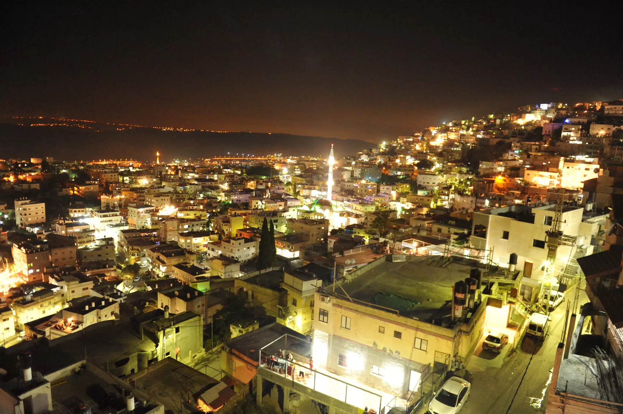
Posted by SODKI - دير الاسد منظر ليلي صورها لكم صدقي الاسدي 20-8-2011

Posted by SODKI - صورة اخرى لقرية ديرالاسد من تصوير صدقي الاسدي 20-8-2011
Posted by SODKI - صورة رسم للشيخ عبد القادر الكيلاني من سلالة الشيخ محمد عبد القادر الجيلاني ( الشيخ محمد الاسد) دير الاسد

Posted by SODKI 1 - منظر عام لقرية دير الاسد اخذت من دار ذياب يوسف ذياب بتاريخ 13-5-2011 من تصوير صدقي الاسدي

Posted by SODKI - منظر عام

- منظر عام 1945

- قرية دير الاسد العامرة سنة 1950

- دير الاسد العامرة سنة 1940

- قة شهادة ميلاد علي محمد موسى من أهالي قرية دير الأسد قضاء عكا عام ١٢٥٠ هـ / الموافق عام 1834 م, أي قبل حوالي 195 سنة زمن الدولة العثمانية.
أرسلها لنا مشكوراً متابع الصفحة الأخ عصمان محمد الشقيري.

- هوية عثمانية للمواطن أسعد يوسف الحوراني من مواليد قرية دير إلأسد قضاء عكا في فلسطين زمن العثمانلي عام 1300 هجرية / الموافق عام 1883 ميلادية.

- General view, 2007

- خارطة تُظهِر الحدود والطرق بأنواعها والأماكن المقدسة والطبيعة الطوبغرافية من تلال وسهول ومنحدرات والتشكيلة الطبيعية للأرض وأنواع المزروعات. نُشرت الخريطة فترة الانتداب البريطاني، تم إضافة تعديلات عليها من قِبَل خدمة الخرائط والصور التابعة للقوات العسكرية الاسرائيلية فترة الأربعينيات.

-
انفجار قنبلة ووفاة ثلاثة في قرية دير الاسد -- 4/10/1944 -- حسن محمود حسن / عبد رشيد عبد الحليم / احمد لدار

-
طلب استعلام عن وجود وظيفة مركز معلم صادرة عن مفتش المعارف للمعلم حسن عكاوي
-- 1939

- التفاصيل
نموذج طلب ورقة عمل للمعلم حسن عكاوي صادرة عن ادارة المعارف في حكومة فلسطين، تتناول المؤهلات المعلم عكاوي والمدارس التي تعلم بها سابقاً -- 1939

-
شكوى مقدمة من والد التلميذ فريد سعيد حداد بحق المعلم حسن عكاوي يشكو فيها من ملازمة انبه الفراش نتيجة لضربه من المعلم المذكور -- 24/12/1940

Want to browse more? 80,000 pictures were grouped in these gallaries:
| Display Name | Clan/Hamolah | Country of Residence |
| Abdul Aziz Alasadi | - | Odense, Denmark |
| WASSIM ELASSADI | - | Florida, United States |
| مجدي | - | - |
| SODKI | ASSADI | DIER AL ASSAD, DIER AL ASSAD |
| alwawy | - | odense, Danmark |
| Hafez Sanalla | Assadi | دير الاسد |
| Suad Dabbah | Dabbah | - |
| MOHAMMAD SAEED DABBAH | Dabbah | VIRGINIA, USA |
| JAMAL MOHAMMAD SAEED DABBAH | Dabbah | Sharjah, UAE |
| Mohamed Al-asadi | Al-asadi | Fyn, Denmark |
| Alaa | Alkhatib | lebanon, 00961 |
| nayef | - | deir el-assad \alshagor |
| salih faiyad | akkawi | deir el assad |
| Dalal Assadi | - | Jalil, Israel |
| Osama AL ASADI | AL ASADI | Jordan |
| laila abed | - | - |
- "حكاية بلد"قرية دير الاسد الجزء الاول
- حكاية بلد --قرية دير الاسد الجزء الثاني Duration: 21 min 56 sec
 Fake Valor: Why Did Zionist Jews Hoist Nazis Flag on Their Ships in the 1930s?
What is new?
-
Facts About Oct. 7th Gaza Raid
-
Remined Us Please: Who Did Rape Whom? Was it Palestinians who raped Israelis? Or, was the other way around? You'll be the judge
-
When Prof. Edward Said was invited to debate Bibi Netanyahu in the 1980s, watch what happened!
-
Ezra Klein of the NY Times on the "Jewish Race".
-
Abusing Blood Libel!
-
How and why Israeli Jewry has become the most hated cult?
-
Did Israeli Soldiers Activate The Hannibal Direective On Oct. 7th? You Be The Judge
-
Zionist FAQ: Isn't it true that Palestinians don't want peace? Palestinians never accepted the two-state solution
- Facts about Haavara (Transfer) Agreement between Ben-Gurion & Hitler
-
Haavara FAQs: Why Did Zionist Jews Hoist Nazis' Flags on Their Ships in the 1930s?
- Haavara FAQs: When Chaim Weizmann met FDR in mid-1943, why was he silent about rescuing European Jewry?
-
Dear ChatGPT: How did Palestinians resist Napoleon's invasion of their country in 1799?
-
Dear ChatGPT: Gaza had a vibrant Jewish community in the mid-17th century. What happened to them?
-
Dear ChatGPT: Why did the Jewish Agency suppress news of the Holocaust during WWII?
-
Video Playlist: Jews share their DNA tests to end the conflict for good.
-
A Tale of Two Conflicts: Examining the Definition of Genocide
-
Prof. Abraham Polak And The Suppressed History of the Khazars and European Jewry
-
How Ronald Reagan would have framed the genocide in Gaza if he were still alive?
-
Haavara FAQs: Let us do the math: how many German Jews did The Haavara Agreement save?
-
Zionist FAQs: The Hebron Massacre of 1929, "clearly proves" that Palestinians are antisemitic, how could you deny it?
-
Zionist FAQs: Why Anti-Zionist Is Not Antisemitism?
-
Zionist FAQs: Isn't it true that the KGB created Palestinian Nationalism in the early 1960s?
- Zionist FAQs: Muslims are killing Muslims all the time; why are Israeli Jews being singled out in the media?
- Zionist FAQs: How is Israel an apartheid state when 20% of its citizens are Arabs who enjoy full rights?
-
Haavara FAQs: Why Did Dorothy Thompson Flip From A Zionist Advocate to A Silenced Dissenter?
-
Haavara FAQs: Analysis of Herzl's Uganda Scheme and how it could have saved millions of Jews.
-
Haavara FAQs: Why did Hayim Greenberg describe American Jewry as "morally bankrupt" in early 1943?
-
Haavara FAQs: What if the Evian Conference was a resounding success? What would have been the impact of saving European Jewry on Zionism?
- Haavara FAQs: What if the six million were saved, how that would have impacted the Zionist project?
-
Haavara FAQs: How did Zionist leaders react when Europe's Jews lingered in the DP camps after WWII ended?
-
Why does the American Jewish community repeat lies that David Ben-Gurion had debunked before he died?
-
Who has the power to rename the Tatar/Khazar Gene Marker to Jewish IV?
-
Zionist FAQs: Why won't Egypt, Syria, and Jordan take their people back? Jews are indigenous to Palestine, and Arabs immigrated after Jews developed the country. Arabs should leave.
-
Haavara FAQs: Did Hitler and the Nazis conflate between Judaism and Zionist? If that wasn't case, then why?
-
Haavara FAQs: Winston Churchill and antisemitism, a collection of articles written Churchill.
-
Haavara FAQs: Broken by country, how many Jews survived vs. killed during the Holocaust?
-
Haavara FAQs: Why did European Jews vote with their feet and to immigrated to the Americas, not Palestine, after WWII?
-
Watch this American Jewish Girl describing Israeli Jews' cognitive dissonance like no other in under two minutes
-
Haavara FAQs: When the Nazis went out of their way to hide the Holocaust, Israeli Jews did the exact opposite by broadcasting their genocide of Gazans. But why?
-
Haavara FAQs: How Zionist Jews went out of their to show their appreciation to Nazism and Fascism?
- Haavara FAQs: Why Zionist leaders were against bombing the death camps & the Railroads leading to them?
-
Haavara FAQs: Hitler's message to the British and American people: If Jews are such noble citizens and you care about them, how come you're not letting them in? I will gladly ship them to you at my expense, even on luxury liners!
-
A shortlist of Zionist and Israeli false flag operations in the name Jews.
-
The Most Moral Army
- The Land of Kapos (Israel): Where the brave are boycotted and Kapos walk free.
- Why did early Zionists often named their communal enterprises "colonial"?
- Zionist Relations with Nazi Germany by Faris Glubb
-
Two NY Times advertisements by Zionists in the early 1943 that exposes Zionists' treason at the height of the calamity
- Facts Not Lies about the Palestinian-Israeli Conflict.
- Site's pictures have been categorized
- Campgain Against Lice
- A Survey of Palestine, the official source about Palestine before Nakba produced by the British Mandate; over 1200 pages.
- Satellite View & Google Earth: Over 6,000 placemarks identifying all destroyed towns, W. Bank & Gaza Strip Towns, & refugee camps.
- PalestineRemembered.com and its Nakba Oral History Project were featured on al-Jazeera Satellite TV.
- Nakba Oral History Video Podcast:
 Over 700 Oral History interviews (including 3,500+ hours of recording) can be viewed online.
 - Palestine Village Statistics Project
- Gaza Jail Break
- النسخة العربية للموقع الان متوفرة
- Videos: Documenting the destroyed villages in video: Tracing all that remains since Nakba.
- Videos: Responding to Zionist Propaganda
- Interview: The ethnic cleansing of Palestine: George Galloway interviews Israeli Historian Ilan Pappe.
- For Palestinians, memory matters. It provides a blueprint for their future By George Bisharat.
- Zionist FAQ now available in Hebrew שאלות שציונים שואלים, עכשיו בעברית
- Video: The Stephen Walt and John Mearsheimer report on the influence of the Israel Lobby on U.S. Foreign Policy
- The Palestinian-Israeli conflict for beginners
