| PalestineRemembered | About Us | Oral History | العربية | |
| Pictures | Zionist FAQs | Haavara | Maps | |
| Search |
| Camps |
| Districts |
| Acre |
| Baysan |
| Beersheba |
| Bethlehem |
| Gaza |
| Haifa |
| Hebron |
| Jaffa |
| Jericho |
| Jerusalem |
| Jinin |
| Nablus |
| Nazareth |
| Ramallah |
| al-Ramla |
| Safad |
| Tiberias |
| Tulkarm |
| Donate |
| Contact |
| Profile |
| Videos |
Welcome To Kharbata - خربثا الحارثية (ח'רבת'א בני חרית)
|
District of Ramallah
Occupied days ago |
العربية Google Earth |
 |
Gallery (105) |
- Statistics & Facts
-
Before & After

- Satellite View
- Articles 2
- Pictures 105
- Mayrters & Prisoners 2
- Members 26
- Families
- Wikipedia
- ARIJ Guide
- Videos 1
- Guest Book 21
- Links
| Statistic & Fact | Value | ||||||||||||||||||
| Distance From District | 21 km northwest of Ramallah | ||||||||||||||||||
| Elevation | 400 meters | ||||||||||||||||||
| Before & After Nakba, Click Map For Details |
|||||||||||||||||||

|
|||||||||||||||||||
| Land Ownership |
**Town Lands' Demarcation Maps |
||||||||||||||||||
| Land Usage As of 1945 |
|
||||||||||||||||||
| Population |
|
||||||||||||||||||
| Near By Towns |
|||||||||||||||||||
|
|
|||||||||||||||||||
| Featured Video | |||||||||||||||||||
| ARIJ Guide | |||||||||||||||||||
3.

4. 
5. 
6. 
7. 
8. 
9. 
10. 
11. 
12. 
13. 
14. 
15. 
16. 
17. 
18. 
19. 
Click here to browse online. |
|||||||||||||||||||
| Related Maps | Town Lands' Demarcation Maps خرائط للقضاء توضح حدود القرى والاودية View from satellite Town's map on MapQuest Help us map this town at WikiMapia |
||||||||||||||||||
| Related Links | Wikipedia's Page Facebook Page ARIJ Guide Google Search Google For Images Google For Videos في كتاب بلادنا فلسطين دليل أريج المزيد من موقع هوية |
||||||||||||||||||
- Kharbatha.... spring of 2005
Posted by Mohammed Hamooda 3 - Destruction Israeli style in the village

- Kharbatha.... spring of 2005

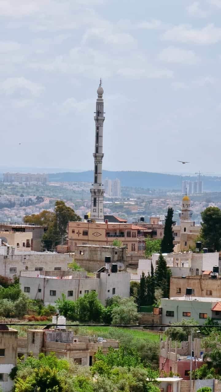
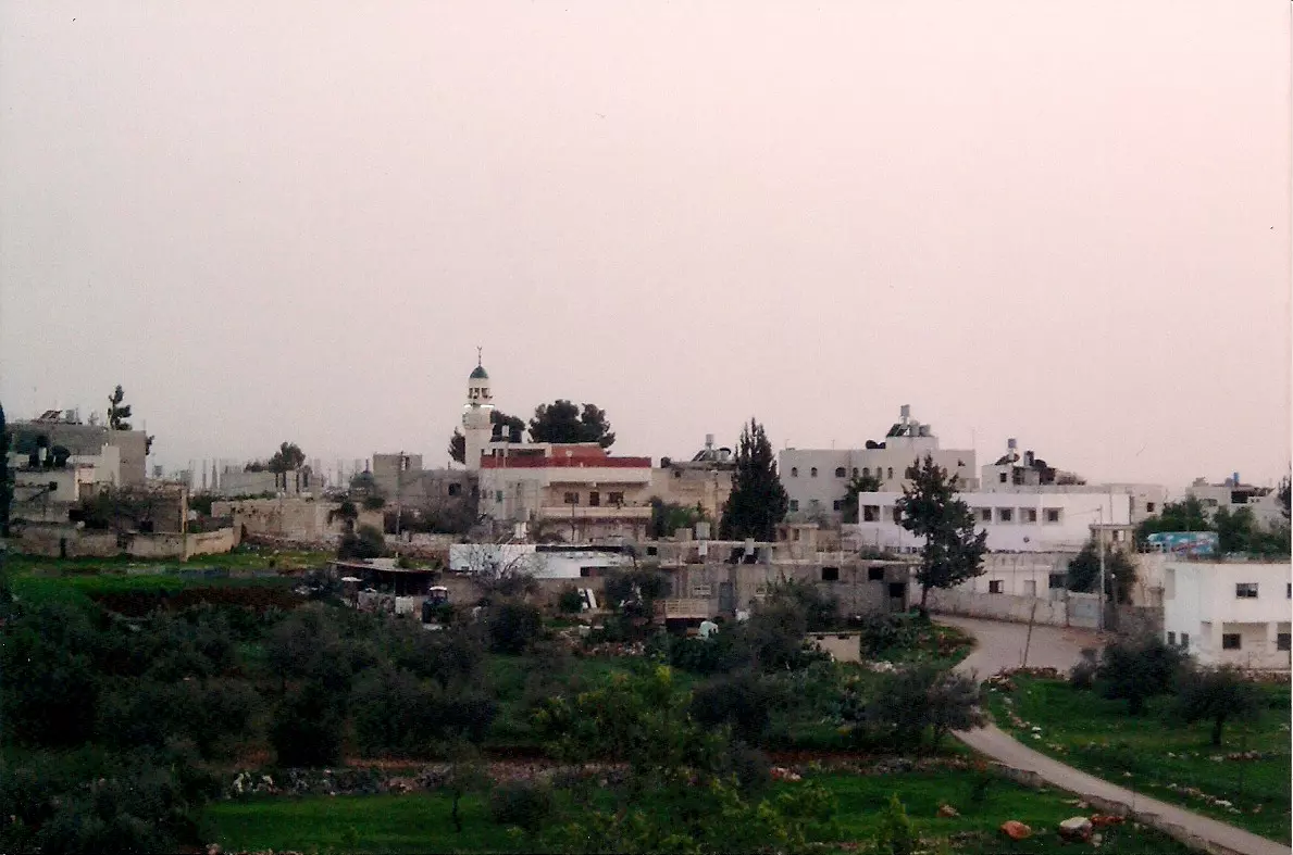
Posted by Mohammed Hamooda 5 - General view

1 - Growing bees

4 - بيوت قديمة

Posted by bilal 2 - beitellos

Posted by Nasser Beitello 2 - صور في منطقة الحرايق

Posted by رفعت عليان 2 - منظر عام لقرية خربثا فصل الربيع 1

Posted by رفعت عليان - منظر عام لقرية خربثا فصل الربيع 2

Posted by رفعت عليان 2 - منظر عام لقرية خربثا فصل الربيع 3

Posted by رفعت عليان 1 - صورة الغروب بس ولا اروع

Posted by رفعت عليان 1 - صورة لمسجد القرية 1

Posted by رفعت عليان - صورة لمسجد القرية 2

Posted by رفعت عليان 5 - صورة لمسجد القرية 2

Posted by رفعت عليان 1 - صورة للمقبرة وخلقية مدرسة البنات

Posted by رفعت عليان - مسجد الفاروق

Posted by bilal - الحاجة زكية نمر ـ ام عمر ـ نلاحظ الثوب الفلسطيني ودقة التطريز وروعة الالوان

Posted by رفعت عليان 9 - Kharbatha in the spring of 2005

Posted by Mohammed Hamooda 2 - Kharbatha... spring of 2005

Posted by Mohammed Hamooda 2 - Kharbatha..... spring of 2005

Posted by Mohammed Hamooda 1 - Kharbatha.... spring of 2005

Posted by Mohammed Hamooda 2 - Kharbatha.... spring of 2005

Posted by Mohammed Hamooda 2 - Kharbatha.... spring of 2005

Posted by Mohammed Hamooda 2 - Kharbatha.... spring of 2005

Posted by Mohammed Hamooda 2 - Kharbatha..... spring of 2005

Posted by Mohammed Hamooda - Kharbatha.... spring of 2005

Posted by Mohammed Hamooda 1 - Kharbatha... spring of 2005

Posted by Mohammed Hamooda 1 - Kharbatha.... spring of 2005

Posted by Mohammed Hamooda 1 - Kharbatha... spring of 2005

Posted by Mohammed Hamooda 1 - Kharbatha..... spring of 2005

Posted by Mohammed Hamooda 1 - Kharbatha.... spring of 2005

Posted by Mohammed Hamooda 1 - Kharbatha.... spring of 2005

Posted by Mohammed Hamooda 1 - Olive press

Posted by Mohammed Hamooda 2 - Figs .... Alteen al asali

Posted by Mohammed Hamooda 1 - Grapes ... Al enab

Posted by Mohammed Hamooda - الأسرى القساميين محمد عرمان ووليد انجاص

Posted by يوسف حسين - The olive oil press as it may have looked

Posted by Mohammed Hamooda - صورة لقرية خربثا بني حارث التقطت من فوق المدرسة

Posted by حسن زهدي لطفي الرفاعي 1 - مفرق عين ايوب المؤدي لقرية خربثا بني حارث من الجهة الشرقية

Posted by حسن زهدي لطفي الرفاعي 1 - الميرمية في جبال خربثا بني حارث

Posted by حسن زهدي لطفي الرفاعي - عش الشنار في خربثا

Posted by حسن زهدي لطفي الرفاعي - ورد

Posted by امير العذاب - خالد حموده

Posted by امير العذاب 1 - مسجد خربثا بني حارث

Posted by خالد حموده - اجمل ورود العالم من خربثا

Posted by خالد حموده - وردة

Posted by خالد حموده - صورة حديثة من خربثا 2015

Posted by زيدان ابو جابر - منظر عام للقرية

Posted by زيدان ابو جابر - صورة حديثة للربيع في خربثا الحارثية

Posted by زيدان ابو جابر - صورة البحر الابيض المتوسط تشاهد من خربثا

Posted by زيدان ابو جابر - الربيع في خربثا

Posted by زيدان ابو جابر - مثلث عين ايوب

Posted by زيدان ابو جابر - مرج السوس

Posted by زيدان ابو جابر - بير ابو عب من الاثار القديمة في القرية

Posted by زيدان ابو جابر - بعض اثار القرية

Posted by زيدان ابو جابر 1 - صورة من البلدة القديمة

Posted by زيدان ابو جابر - صورة من البلدة القديمة

Posted by زيدان ابو جابر - مثلث عين ايوب

Posted by زيدان ابو جابر - باب الطاقة

Posted by زيدان ابو جابر - صورة من وسط البلدة

Posted by زيدان ابو جابر - صورة من البلدة القديمة

Posted by زيدان ابو جابر - منظر عام للقرية

Posted by زيدان ابو جابر - صورة من البلدة القديمة

Posted by زيدان ابو جابر - صورة من البلدة القديمة

Posted by زيدان ابو جابر - موقع شتورة

Posted by زيدان ابو جابر - عرس قديم من القرية

Posted by زيدان ابو جابر - اليمين ... محمد هيجر ومحمد يوسف حسين (طيون)حمدي و ذيب ابو صبيحة و عبد الحميد حمدي و راشد خضر حموده و ذياب عبد القادر رشيد

Posted by زيدان ابو جابر - منظر للبلدة القديمة

Posted by زيدان ابو جابر 1 - منظر عام

- من البيوت القديمة في قرية خربثا بني حارث ---تصوير : نسيم يوسف نمر

- من البيوت القديمة في قرية خربثا بني حارث ---تصوير : نسيم يوسف نمر #2

- من البيوت القديمة في قرية خربثا بني حارث ---تصوير : نسيم يوسف نمر #3

- من البيوت القديمة في قرية خربثا بني حارث ---تصوير : نسيم يوسف نمر #4

- من البيوت القديمة في قرية خربثا بني حارث ---تصوير : نسيم يوسف نمر #5

- من البيوت القديمة في قرية خربثا بني حارث ---تصوير : نسيم يوسف نمر #6

- من البيوت القديمة في قرية خربثا بني حارث ---تصوير : نسيم يوسف نمر #7

- من البيوت القديمة في قرية خربثا بني حارث ---تصوير : نسيم يوسف نمر #8

- من البيوت القديمة في قرية خربثا بني حارث ---تصوير : نسيم يوسف نمر #9

- من البيوت القديمة في قرية خربثا بني حارث ---تصوير : نسيم يوسف نمر #10

- من البيوت القديمة في قرية خربثا بني حارث ---تصوير : نسيم يوسف نمر #11

- منظر عام --- Naseem Yousif

- منظر عام --- Naseem Yousif #2

- منظر عام --- Naseem Yousif #3

- منظر عام --- Naseem Yousif #4

- احد بيوت القرية القديمة -- Yousif Odeh

- احد بيوت القرية القديمة -- Yousif Odeh #2

- احد بيوت القرية القديمة -- Yousif Odeh #3

- احد بيوت القرية القديمة -- Yousif Odeh #4

- احد بيوت القرية القديمة -- Yousif Odeh #5

- احد بيوت القرية القديمة -- Yousif Odeh #6

- بيت قديم -- يوسف عودة

- جولة رائعة بين بيوت القرية القديمة -- Yousif Odeh

- جولة رائعة بين بيوت القرية القديمة -- Yousif Odeh #2

- جولة رائعة بين بيوت القرية القديمة -- Yousif Odeh #3

- جولة رائعة بين بيوت القرية القديمة -- Yousif Odeh #4

- جولة رائعة بين بيوت القرية القديمة -- Yousif Odeh #5

- جولة رائعة بين بيوت القرية القديمة -- Yousif Odeh #6

- جولة رائعة بين بيوت القرية القديمة -- Yousif Odeh #7

- جولة رائعة بين بيوت القرية القديمة -- Yousif Odeh #8

- جولة رائعة بين بيوت القرية القديمة -- Yousif Odeh #9

- جولة رائعة بين بيوت القرية القديمة -- Yousif Odeh #10

- منظر عام
- منظر عام من الغرب

- جرافات الجيش الإسرائيلي تهدم مصنعاً للإسمنت في قرية خربثا بني حارث غرب رام الله

Want to browse more? 80,000 pictures were grouped in these gallaries:
| Display Name | Clan/Hamolah | Country of Residence |
| زيدان ابو جابر | - | الاردن, الاردن |
| Fatih Egemen Hamdi | Hamdi | Istanbul, Turkey |
| محمد دحبور | بيتلو | مادبا-الاردن |
| زيدان ابو جابر | الشيخ | الاردن, الأردن |
| محمد ال حمودة | ال حمودة | amman, jordan |
| Rami Hamdi | - | - |
| سيد الاحساس | ال يوسف | الدمام, السعودية |
| khaled Abuhamdeh | Abu Hamdeh | - |
| الحكيم | انجاص | - |
| Abu Nabil | - | Missouri, USA-Kharbatha |
| Um Amaly | - | Missouri, USA |
| Um Ali | - | Missouri, USA |
| Omar Injas | - | Missouri, Kharbatha |
| Mu'ath Nimer | - | Amman, Jordan |
| eman nimer | - | Amman, Jordan |
| bayan nimer | - | Amman, Jordan |
| maya ahmad | - | فلسطين, بيت حنينا |
| oday injas | injas | - |
| Malik Awad Engas | Injass | Texas, Kharbatha |
| الخربثاوي | ابو حمدي | عمان, jordan |
| رفعت عليان | عليان | رام الله, خربثا |
| احمد حمودة | حمودة | فلسطين, خربتا |
| Samer Shawqi Abuhamdeh | Abu Hamdeh | - |
| BNO KNK | Amira عميرة | Virginia, falasten |
| bilal | دار الشيخ | رام الله, خربثا |
| Omar Masri | - | - |
- مرورا من قرية خربثا بني حارث Duration: 4 min 6 sec
No links have been shared yet, be free to the first to share the first link.
 Fake Valor: Why Did Zionist Jews Hoist Nazis Flag on Their Ships in the 1930s?
What is new?
-
Facts About Oct. 7th Gaza Raid
-
Remined Us Please: Who Did Rape Whom? Was it Palestinians who raped Israelis? Or, was the other way around? You'll be the judge
-
When Prof. Edward Said was invited to debate Bibi Netanyahu in the 1980s, watch what happened!
-
Ezra Klein of the NY Times on the "Jewish Race".
-
Abusing Blood Libel!
-
How and why Israeli Jewry has become the most hated cult?
-
Did Israeli Soldiers Activate The Hannibal Direective On Oct. 7th? You Be The Judge
-
Zionist FAQ: Isn't it true that Palestinians don't want peace? Palestinians never accepted the two-state solution
- Facts about Haavara (Transfer) Agreement between Ben-Gurion & Hitler
-
Haavara FAQs: Why Did Zionist Jews Hoist Nazis' Flags on Their Ships in the 1930s?
- Haavara FAQs: When Chaim Weizmann met FDR in mid-1943, why was he silent about rescuing European Jewry?
-
Dear ChatGPT: How did Palestinians resist Napoleon's invasion of their country in 1799?
-
Dear ChatGPT: Gaza had a vibrant Jewish community in the mid-17th century. What happened to them?
-
Dear ChatGPT: Why did the Jewish Agency suppress news of the Holocaust during WWII?
-
Video Playlist: Jews share their DNA tests to end the conflict for good.
-
A Tale of Two Conflicts: Examining the Definition of Genocide
-
Prof. Abraham Polak And The Suppressed History of the Khazars and European Jewry
-
How Ronald Reagan would have framed the genocide in Gaza if he were still alive?
-
Haavara FAQs: Let us do the math: how many German Jews did The Haavara Agreement save?
-
Zionist FAQs: The Hebron Massacre of 1929, "clearly proves" that Palestinians are antisemitic, how could you deny it?
-
Zionist FAQs: Why Anti-Zionist Is Not Antisemitism?
-
Zionist FAQs: Isn't it true that the KGB created Palestinian Nationalism in the early 1960s?
- Zionist FAQs: Muslims are killing Muslims all the time; why are Israeli Jews being singled out in the media?
- Zionist FAQs: How is Israel an apartheid state when 20% of its citizens are Arabs who enjoy full rights?
-
Haavara FAQs: Why Did Dorothy Thompson Flip From A Zionist Advocate to A Silenced Dissenter?
-
Haavara FAQs: Analysis of Herzl's Uganda Scheme and how it could have saved millions of Jews.
-
Haavara FAQs: Why did Hayim Greenberg describe American Jewry as "morally bankrupt" in early 1943?
-
Haavara FAQs: What if the Evian Conference was a resounding success? What would have been the impact of saving European Jewry on Zionism?
- Haavara FAQs: What if the six million were saved, how that would have impacted the Zionist project?
-
Haavara FAQs: How did Zionist leaders react when Europe's Jews lingered in the DP camps after WWII ended?
-
Why does the American Jewish community repeat lies that David Ben-Gurion had debunked before he died?
-
Who has the power to rename the Tatar/Khazar Gene Marker to Jewish IV?
-
Zionist FAQs: Why won't Egypt, Syria, and Jordan take their people back? Jews are indigenous to Palestine, and Arabs immigrated after Jews developed the country. Arabs should leave.
-
Haavara FAQs: Did Hitler and the Nazis conflate between Judaism and Zionist? If that wasn't case, then why?
-
Haavara FAQs: Winston Churchill and antisemitism, a collection of articles written Churchill.
-
Haavara FAQs: Broken by country, how many Jews survived vs. killed during the Holocaust?
-
Haavara FAQs: Why did European Jews vote with their feet and to immigrated to the Americas, not Palestine, after WWII?
-
Watch this American Jewish Girl describing Israeli Jews' cognitive dissonance like no other in under two minutes
-
Haavara FAQs: When the Nazis went out of their way to hide the Holocaust, Israeli Jews did the exact opposite by broadcasting their genocide of Gazans. But why?
-
Haavara FAQs: How Zionist Jews went out of their to show their appreciation to Nazism and Fascism?
- Haavara FAQs: Why Zionist leaders were against bombing the death camps & the Railroads leading to them?
-
Haavara FAQs: Hitler's message to the British and American people: If Jews are such noble citizens and you care about them, how come you're not letting them in? I will gladly ship them to you at my expense, even on luxury liners!
-
A shortlist of Zionist and Israeli false flag operations in the name Jews.
-
The Most Moral Army
- The Land of Kapos (Israel): Where the brave are boycotted and Kapos walk free.
- Why did early Zionists often named their communal enterprises "colonial"?
- Zionist Relations with Nazi Germany by Faris Glubb
-
Two NY Times advertisements by Zionists in the early 1943 that exposes Zionists' treason at the height of the calamity
- Facts Not Lies about the Palestinian-Israeli Conflict.
- Site's pictures have been categorized
- Campgain Against Lice
- A Survey of Palestine, the official source about Palestine before Nakba produced by the British Mandate; over 1200 pages.
- Satellite View & Google Earth: Over 6,000 placemarks identifying all destroyed towns, W. Bank & Gaza Strip Towns, & refugee camps.
- PalestineRemembered.com and its Nakba Oral History Project were featured on al-Jazeera Satellite TV.
- Nakba Oral History Video Podcast:
 Over 700 Oral History interviews (including 3,500+ hours of recording) can be viewed online.
 - Palestine Village Statistics Project
- Gaza Jail Break
- النسخة العربية للموقع الان متوفرة
- Videos: Documenting the destroyed villages in video: Tracing all that remains since Nakba.
- Videos: Responding to Zionist Propaganda
- Interview: The ethnic cleansing of Palestine: George Galloway interviews Israeli Historian Ilan Pappe.
- For Palestinians, memory matters. It provides a blueprint for their future By George Bisharat.
- Zionist FAQ now available in Hebrew שאלות שציונים שואלים, עכשיו בעברית
- Video: The Stephen Walt and John Mearsheimer report on the influence of the Israel Lobby on U.S. Foreign Policy
- The Palestinian-Israeli conflict for beginners
