| PalestineRemembered | About Us | Oral History | العربية | |
| Pictures | Zionist FAQs | Haavara | Maps | |
| Search |
| Camps |
| Districts |
| Acre |
| Baysan |
| Beersheba |
| Bethlehem |
| Gaza |
| Haifa |
| Hebron |
| Jaffa |
| Jericho |
| Jerusalem |
| Jinin |
| Nablus |
| Nazareth |
| Ramallah |
| al-Ramla |
| Safad |
| Tiberias |
| Tulkarm |
| Donate |
| Contact |
| Profile |
| Videos |
Welcome To 'Abud - عابود (עאבוד)
|
District of Ramallah
Occupied days ago |
العربية Google Earth |
 |
Gallery (113) |
- Statistics & Facts
-
Before & After

- Satellite View
- Articles 4
- Pictures 113
- Members 19
- Families
- Wikipedia
- ARIJ Guide
- Videos 4
- Guest Book 8
- Links 1
| Statistic & Fact | Value | ||||||||||||||||||||||
| Distance From District | 24 km west of Ramallah | ||||||||||||||||||||||
| Elevation | 450 meters | ||||||||||||||||||||||
| Before & After Nakba, Click Map For Details |
|||||||||||||||||||||||

|
|||||||||||||||||||||||
| Land Ownership |
**Town Lands' Demarcation Maps |
||||||||||||||||||||||
| Land Usage As of 1945 |
|
||||||||||||||||||||||
| Population |
|
||||||||||||||||||||||
| Near By Towns |
|||||||||||||||||||||||
|
|||||||||||||||||||||||
| Featured Video | |||||||||||||||||||||||
| ARIJ Guide | |||||||||||||||||||||||
3.

4. 
5. 
6. 
7. 
8. 
9. 
10. 
11. 
12. 
13. 
14. 
15. 
16. 
17. 
18. 
19. 
20. 
Click here to browse online. |
|||||||||||||||||||||||
| Related Maps | Town Lands' Demarcation Maps خرائط للقضاء توضح حدود القرى والاودية View from satellite Town's map on MapQuest Help us map this town at WikiMapia |
||||||||||||||||||||||
| Related Links | Wikipedia's Page Facebook Page ARIJ Guide Google Search Google For Images Google For Videos في كتاب بلادنا فلسطين دليل أريج المزيد من موقع هوية |
||||||||||||||||||||||
- Town of Abud from another hillside (near Shrine of St. Barbara)
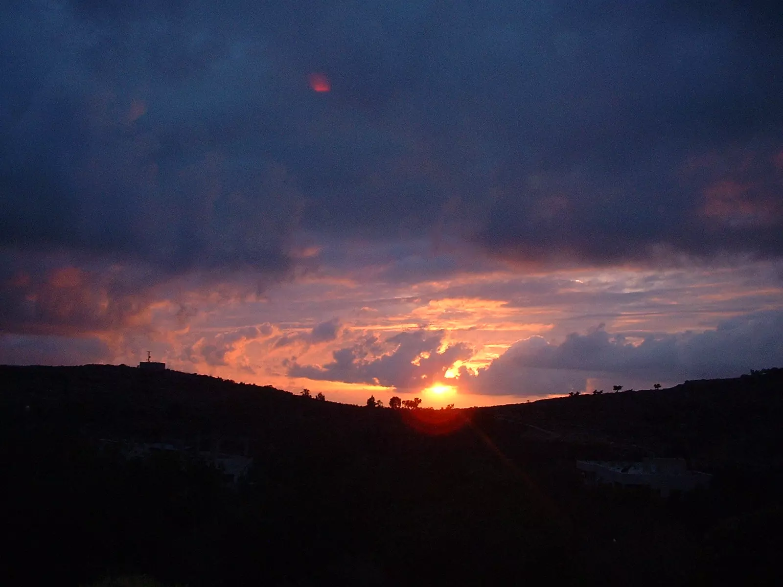
Posted by Peter Miller 4 - عند الغروب
Posted by peter saleh 4 - منظر في البلدة القديمة

Posted by peter saleh 4 - الطبيعة المحيطة

Posted by peter saleh - ancient ruins next to aboud (المقاطع)

Posted by peter saleh 4 - كنيسة الروم الاورثودكس - عابود

Posted by peter saleh 4 - داخل كنيسة الروم الاورثودكس

Posted by peter saleh 2 - الكنيسه الكاثولكيه فى عابود

Posted by peter saleh 1 - Chruch of God

Posted by peter saleh 1 - alzarka next to aboud

Posted by peter saleh 5 - an old house in aboud.....

Posted by peter saleh - المسجد

Posted by peter saleh 2 - من وسائل التدقئة (الكانون)

Posted by عبدالهادي جعيدي 3 - ميرمية بين الصخور

Posted by عبدالهادي جعيدي 2 - نبع عين الزرقاء - عابود

Posted by عبدالهادي جعيدي 3 - مبنى الحاووز- وادي الليمون

Posted by عبدالهادي جعيدي 3 - نادي شباب عابود

Posted by عبدالهادي جعيدي 5 - الصفطي - من أثارات عابود

Posted by عبدالهادي جعيدي 1 - موقع أثري-بربارا بعد التحديث نتيجة هدمها من قبل الاحتلال

Posted by عبدالهادي جعيدي - موقع أثري-بربارا من الداخل

Posted by عبدالهادي جعيدي - عابود- البلدة القديمة/ الحارة الفوقة

Posted by عبدالهادي جعيدي 2 - عابود- النادي

Posted by عبدالهادي جعيدي 2 - الطريق الى رام الله

Posted by Ghanem Mustafa - abuod

Posted by abuod - abuod

Posted by abuod 1 - كنيسه الروم الارثوذكس سنه 1932

Posted by abu raya - المرحوم حميدة البرغوثي في أحد أعراس دير بلوط

Posted by Ghanem Mustafa 1 - المرحوم حميدة البرغوثي في أحد أعراس دير بلوط

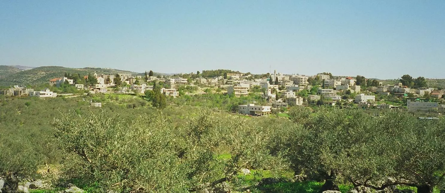
Posted by Ghanem Mustafa - منظر عام

- مجموعة المتراس في جبال قرية عابود-- واجد النوباني

- مجموعة المتراس في جبال قرية عابود-- واجد النوباني #2

- مجموعة المتراس في جبال قرية عابود-- واجد النوباني #3

- مجموعة المتراس في جبال قرية عابود-- واجد النوباني #4

- مجموعة المتراس في جبال قرية عابود-- واجد النوباني #5

- مجموعة المتراس في جبال قرية عابود-- واجد النوباني #6

- مجموعة المتراس في جبال قرية عابود-- واجد النوباني #7

- مجموعة المتراس في جبال قرية عابود-- واجد النوباني #8

- مجموعة المتراس في جبال قرية عابود-- واجد النوباني #9

- مجموعة المتراس في جبال قرية عابود-- واجد النوباني #10

- مجموعة المتراس في جبال قرية عابود-- واجد النوباني #11

- مجموعة المتراس في جبال قرية عابود-- واجد النوباني #12

- مجموعة المتراس في جبال قرية عابود-- واجد النوباني #13

- مجموعة المتراس في جبال قرية عابود-- واجد النوباني #14

- مجموعة المتراس في جبال قرية عابود-- واجد النوباني #15

- مجموعة المتراس في جبال قرية عابود-- واجد النوباني #16

- مجموعة المتراس في جبال قرية عابود-- واجد النوباني #17

- مجموعة المتراس في جبال قرية عابود-- واجد النوباني #18

- مجموعة المتراس في جبال قرية عابود-- واجد النوباني #19

- مجموعة المتراس في جبال قرية عابود-- واجد النوباني #20

- إطلاله على احد الخرب -- واجد النوباني

- إطلاله على احد الخرب -- واجد النوباني #2

- إطلاله على احد الخرب -- واجد النوباني #3

- إطلاله على احد الخرب -- واجد النوباني #4

- إطلاله على احد الخرب -- واجد النوباني #5

- منظر عام -- واجد النوباني

- جولة سياحية في معالم القرية القديمة -- واجد النوباني

- جولة سياحية في معالم القرية القديمة -- واجد النوباني #2

- جولة سياحية في معالم القرية القديمة -- واجد النوباني #3

- جولة سياحية في معالم القرية القديمة -- واجد النوباني #4

- جولة سياحية في معالم القرية القديمة -- واجد النوباني #5

- جولة سياحية في معالم القرية القديمة -- واجد النوباني #6

- جولة سياحية في معالم القرية القديمة -- واجد النوباني #7

- جولة سياحية في معالم القرية القديمة -- واجد النوباني #8

- جولة سياحية في معالم القرية القديمة -- واجد النوباني #9

- جولة سياحية في معالم القرية القديمة -- واجد النوباني #10

- جولة سياحية في معالم القرية القديمة -- واجد النوباني #11

- جولة سياحية في معالم القرية القديمة -- واجد النوباني #12

- جولة سياحية في معالم القرية القديمة -- واجد النوباني #13

- جولة سياحية في معالم القرية القديمة -- واجد النوباني #14

- جولة سياحية في معالم القرية القديمة -- واجد النوباني #15

- صور جوية لقرية عابود -- Mahmoud Moutan
- صور جوية لقرية عابود -- Mahmoud Moutan #2

- صور جوية لقرية عابود -- Mahmoud Moutan #3

- صور جوية لقرية عابود -- Mahmoud Moutan #4

- صور جوية لقرية عابود -- Mahmoud Moutan #5

- صور جوية لقرية عابود -- Mahmoud Moutan #6

- صور جوية لقرية عابود -- Mahmoud Moutan #7

- صور جوية لقرية عابود -- Mahmoud Moutan #8

- جولة في وادي الليمون -- محمد أبو نوح

- جولة في وادي الليمون -- محمد أبو نوح #2

- جولة في وادي الليمون -- محمد أبو نوح #3

- عين الزرقا،، عابود -- 2023 -- يوسف عودة

- عين الزرقا،، عابود -- 2023 -- يوسف عودة #2

- عين الزرقا،، عابود -- 2023 -- يوسف عودة #3

- عين الزرقا،، عابود -- 2023 -- يوسف عودة #4

- المعالم الأثرية الجميلة بقرية عابود -- محمود معطان

- المعالم الأثرية الجميلة بقرية عابود -- محمود معطان #2

- المعالم الأثرية الجميلة بقرية عابود -- محمود معطان #3

- المعالم الأثرية الجميلة بقرية عابود -- محمود معطان #4

- المعالم الأثرية الجميلة بقرية عابود -- محمود معطان #5

- المعالم الأثرية الجميلة بقرية عابود -- محمود معطان #6

- المعالم الأثرية الجميلة بقرية عابود -- محمود معطان #7

- المعالم الأثرية الجميلة بقرية عابود -- محمود معطان #8

- لقطة نادرة من قلب البلد، قبل ما يزحف العمران ويغير ملامح الحجر والشجر... المعالم في قسم التعليقات اسفل الصورة

1 - واد الليمون -- يوسف عودة

- من واد الليمون -- يوسف عودة

- من واد الليمون -- يوسف عودة

- مدخل حجري قديم لحوش دار البلاص، يعلوه قوس مغطى بأغصان خضراء وزواحف برّية نمت مع الزمن. الحجارة باهتة ومتشققة من أثر الشمس والسنين، والممر خلف القوس ضيّق تحيط به جدران مهدّمة ونباتات يابسة. يروي بصمته حكاية دار هجَرها أهلها وبقيت شاهدة على الزمن

- نفس الزاوية… بس فرق ٣٥ سنة.

- صورة قديمة من قرية عابود قضاء رام الله تحت شجرة توت كبيرة يتجمع تحتها اهالي البلدة

- Church of St Mary (Sitti Miriam) in 1932

- Near the ruined St Barbara church, 2017

- منطقة المقاطع الأثرية التي تضم قبورا أثرية ومنطقة لقطع الحجر بطريقة هندسية جميلة ..إلى الشمال الغربي من مركز القرية -- Mahmoud Moutah

- منطقة المقاطع الأثرية التي تضم قبورا أثرية ومنطقة لقطع الحجر بطريقة هندسية جميلة ..إلى الشمال الغربي من مركز القرية -- Mahmoud Moutah #2

- منطقة المقاطع الأثرية التي تضم قبورا أثرية ومنطقة لقطع الحجر بطريقة هندسية جميلة ..إلى الشمال الغربي من مركز القرية -- Mahmoud Moutah #3

- منطقة المقاطع الأثرية التي تضم قبورا أثرية ومنطقة لقطع الحجر بطريقة هندسية جميلة ..إلى الشمال الغربي من مركز القرية -- Mahmoud Moutah #4

- منطقة المقاطع الأثرية التي تضم قبورا أثرية ومنطقة لقطع الحجر بطريقة هندسية جميلة ..إلى الشمال الغربي من مركز القرية -- Mahmoud Moutah #5

- منطقة المقاطع الأثرية التي تضم قبورا أثرية ومنطقة لقطع الحجر بطريقة هندسية جميلة ..إلى الشمال الغربي من مركز القرية -- Mahmoud Moutah #6

- منطقة المقاطع الأثرية التي تضم قبورا أثرية ومنطقة لقطع الحجر بطريقة هندسية جميلة ..إلى الشمال الغربي من مركز القرية -- Mahmoud Moutah #7

- منطقة المقاطع الأثرية التي تضم قبورا أثرية ومنطقة لقطع الحجر بطريقة هندسية جميلة ..إلى الشمال الغربي من مركز القرية -- Mahmoud Moutah #8

- منطقة المقاطع الأثرية التي تضم قبورا أثرية ومنطقة لقطع الحجر بطريقة هندسية جميلة ..إلى الشمال الغربي من مركز القرية -- Mahmoud Moutah #9

- منطقة المقاطع الأثرية التي تضم قبورا أثرية ومنطقة لقطع الحجر بطريقة هندسية جميلة ..إلى الشمال الغربي من مركز القرية -- Mahmoud Moutah #10

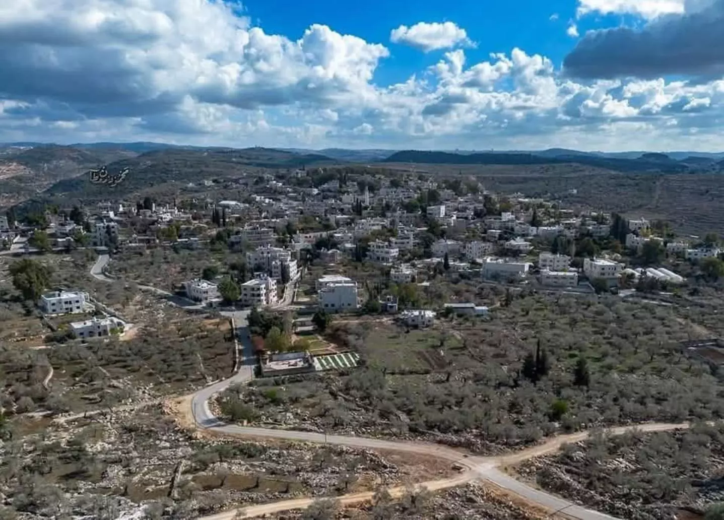
- منظر رائع من الجو -- نصري لدعة

Want to browse more? 80,000 pictures were grouped in these gallaries:
| Display Name | Clan/Hamolah | Country of Residence |
| حازم البرغوثي | ابو حسين | الزرقاء, الاردن |
| حمد حسين | البرغوثي | AMMAN, JORDAN |
| عمر حسين | البرغوثي | عمان, الاردن |
| اريج | جعيدي | الاردن, عمان |
| المرحل | البرغوثي | - |
| وائل المهتدي | - | الاردن |
| عاشق الاقصى | البرغوثي | رام االه |
| ابو عدي | البرغوثي | - |
| مهند الزقف | البرغوثي | IL, USA |
| محمد الزقف | البرغوثي | IL, USA |
| ابو محمود | عبدالمجيد | - |
| jafar albarghouthy | - | Aboud |
| مهند فواز البرغوثي | فلسطيني | الرياض, الرياض |
| ابو العز | - | - |
| محمد صبيحة | - | - |
| عبدالهادي جعيدي | - | رام الله, فلسطين |
| جواد البرغوثي | البرغوثي | عمان , عمان |
| Abe | Saleh | USA |
| peter saleh | - | Aboud |
- حلوة يا دنيا - تقرير عن بلدة عابود - فلسطين Duration: 13 min 42 sec
- زيارة لبيت سلامة خوري Duration: min
- من قرانا || انجازات وتحديات وتطلعات لقرية عابود قضاء رام الله Duration: 16 min 12 sec
- ينابيع قرية عابود قضاء رام الله المهددة بالاستيلاء والتجفيف Duration: 13 min 15 sec
 Fake Valor: Why Did Zionist Jews Hoist Nazis Flag on Their Ships in the 1930s?
What is new?
-
Facts About Oct. 7th Gaza Raid
-
Remined Us Please: Who Did Rape Whom? Was it Palestinians who raped Israelis? Or, was the other way around? You'll be the judge
-
When Prof. Edward Said was invited to debate Bibi Netanyahu in the 1980s, watch what happened!
-
Ezra Klein of the NY Times on the "Jewish Race".
-
Abusing Blood Libel!
-
How and why Israeli Jewry has become the most hated cult?
-
Did Israeli Soldiers Activate The Hannibal Direective On Oct. 7th? You Be The Judge
-
Zionist FAQ: Isn't it true that Palestinians don't want peace? Palestinians never accepted the two-state solution
- Facts about Haavara (Transfer) Agreement between Ben-Gurion & Hitler
-
Haavara FAQs: Why Did Zionist Jews Hoist Nazis' Flags on Their Ships in the 1930s?
- Haavara FAQs: When Chaim Weizmann met FDR in mid-1943, why was he silent about rescuing European Jewry?
-
Dear ChatGPT: How did Palestinians resist Napoleon's invasion of their country in 1799?
-
Dear ChatGPT: Gaza had a vibrant Jewish community in the mid-17th century. What happened to them?
-
Dear ChatGPT: Why did the Jewish Agency suppress news of the Holocaust during WWII?
-
Video Playlist: Jews share their DNA tests to end the conflict for good.
-
A Tale of Two Conflicts: Examining the Definition of Genocide
-
Prof. Abraham Polak And The Suppressed History of the Khazars and European Jewry
-
How Ronald Reagan would have framed the genocide in Gaza if he were still alive?
-
Haavara FAQs: Let us do the math: how many German Jews did The Haavara Agreement save?
-
Zionist FAQs: The Hebron Massacre of 1929, "clearly proves" that Palestinians are antisemitic, how could you deny it?
-
Zionist FAQs: Why Anti-Zionist Is Not Antisemitism?
-
Zionist FAQs: Isn't it true that the KGB created Palestinian Nationalism in the early 1960s?
- Zionist FAQs: Muslims are killing Muslims all the time; why are Israeli Jews being singled out in the media?
- Zionist FAQs: How is Israel an apartheid state when 20% of its citizens are Arabs who enjoy full rights?
-
Haavara FAQs: Why Did Dorothy Thompson Flip From A Zionist Advocate to A Silenced Dissenter?
-
Haavara FAQs: Analysis of Herzl's Uganda Scheme and how it could have saved millions of Jews.
-
Haavara FAQs: Why did Hayim Greenberg describe American Jewry as "morally bankrupt" in early 1943?
-
Haavara FAQs: What if the Evian Conference was a resounding success? What would have been the impact of saving European Jewry on Zionism?
- Haavara FAQs: What if the six million were saved, how that would have impacted the Zionist project?
-
Haavara FAQs: How did Zionist leaders react when Europe's Jews lingered in the DP camps after WWII ended?
-
Why does the American Jewish community repeat lies that David Ben-Gurion had debunked before he died?
-
Who has the power to rename the Tatar/Khazar Gene Marker to Jewish IV?
-
Zionist FAQs: Why won't Egypt, Syria, and Jordan take their people back? Jews are indigenous to Palestine, and Arabs immigrated after Jews developed the country. Arabs should leave.
-
Haavara FAQs: Did Hitler and the Nazis conflate between Judaism and Zionist? If that wasn't case, then why?
-
Haavara FAQs: Winston Churchill and antisemitism, a collection of articles written Churchill.
-
Haavara FAQs: Broken by country, how many Jews survived vs. killed during the Holocaust?
-
Haavara FAQs: Why did European Jews vote with their feet and to immigrated to the Americas, not Palestine, after WWII?
-
Watch this American Jewish Girl describing Israeli Jews' cognitive dissonance like no other in under two minutes
-
Haavara FAQs: When the Nazis went out of their way to hide the Holocaust, Israeli Jews did the exact opposite by broadcasting their genocide of Gazans. But why?
-
Haavara FAQs: How Zionist Jews went out of their to show their appreciation to Nazism and Fascism?
- Haavara FAQs: Why Zionist leaders were against bombing the death camps & the Railroads leading to them?
-
Haavara FAQs: Hitler's message to the British and American people: If Jews are such noble citizens and you care about them, how come you're not letting them in? I will gladly ship them to you at my expense, even on luxury liners!
-
A shortlist of Zionist and Israeli false flag operations in the name Jews.
-
The Most Moral Army
- The Land of Kapos (Israel): Where the brave are boycotted and Kapos walk free.
- Why did early Zionists often named their communal enterprises "colonial"?
- Zionist Relations with Nazi Germany by Faris Glubb
-
Two NY Times advertisements by Zionists in the early 1943 that exposes Zionists' treason at the height of the calamity
- Facts Not Lies about the Palestinian-Israeli Conflict.
- Site's pictures have been categorized
- Campgain Against Lice
- A Survey of Palestine, the official source about Palestine before Nakba produced by the British Mandate; over 1200 pages.
- Satellite View & Google Earth: Over 6,000 placemarks identifying all destroyed towns, W. Bank & Gaza Strip Towns, & refugee camps.
- PalestineRemembered.com and its Nakba Oral History Project were featured on al-Jazeera Satellite TV.
- Nakba Oral History Video Podcast:
 Over 700 Oral History interviews (including 3,500+ hours of recording) can be viewed online.
 - Palestine Village Statistics Project
- Gaza Jail Break
- النسخة العربية للموقع الان متوفرة
- Videos: Documenting the destroyed villages in video: Tracing all that remains since Nakba.
- Videos: Responding to Zionist Propaganda
- Interview: The ethnic cleansing of Palestine: George Galloway interviews Israeli Historian Ilan Pappe.
- For Palestinians, memory matters. It provides a blueprint for their future By George Bisharat.
- Zionist FAQ now available in Hebrew שאלות שציונים שואלים, עכשיו בעברית
- Video: The Stephen Walt and John Mearsheimer report on the influence of the Israel Lobby on U.S. Foreign Policy
- The Palestinian-Israeli conflict for beginners
