| PalestineRemembered | About Us | Oral History | العربية | |
| Pictures | Zionist FAQs | Haavara | Maps | |
| Search |
| Camps |
| Districts |
| Acre |
| Baysan |
| Beersheba |
| Bethlehem |
| Gaza |
| Haifa |
| Hebron |
| Jaffa |
| Jericho |
| Jerusalem |
| Jinin |
| Nablus |
| Nazareth |
| Ramallah |
| al-Ramla |
| Safad |
| Tiberias |
| Tulkarm |
| Donate |
| Contact |
| Profile |
| Videos |
Welcome To Kafr Manda - كفر مندا (כפר מנדא)
|
District of Nazareth
Occupied days ago |
العربية Google Earth |
 |
Gallery (71) |
- Statistics & Facts
-
Before & After

- Satellite View
- Articles
- Pictures 71
- Aerial Views 1
- Mayrters & Prisoners 6
- Members 2
- Wikipedia
- Videos 1
- Guest Book
- Links
| Statistic & Fact | Value | ||||||||||||||||||||
| Distance From District | 15 km north of Nazareth | ||||||||||||||||||||
| Elevation | 170 meters | ||||||||||||||||||||
| Before & After Nakba, Click Map For Details |
|||||||||||||||||||||

|
|||||||||||||||||||||
| Pre-Nakba Aerial View |
|||||||||||||||||||||

|
|||||||||||||||||||||
| Land Ownership |
**Town Lands' Demarcation Maps |
||||||||||||||||||||
| Land Usage As of 1945 |
|
||||||||||||||||||||
| Usurped Land as of 1972 | 8,723 Dunums | ||||||||||||||||||||
| Usurped Land as of 1962 | 9,135 Dunums | ||||||||||||||||||||
| Population |
|
||||||||||||||||||||
| Near By Towns |
|||||||||||||||||||||
|
|||||||||||||||||||||
| Related Maps | Town Lands' Demarcation Maps خرائط للقضاء توضح حدود القرى والاودية View from satellite Town's map on MapQuest Help us map this town at WikiMapia |
||||||||||||||||||||
| Related Links | Wikipedia's Page Facebook Page Google Search Google For Images Google For Videos في كتاب بلادنا فلسطين المزيد من موقع هوية |
||||||||||||||||||||
No articles have been added yet, please be free to be the first to add one.
- صوره التقطت من وسط البلده الى الناحيه الجنوبيه
Posted by صقر الجليل - منظر عام

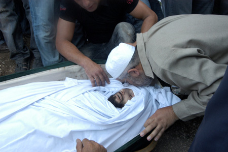
Posted by صقر الجليل - جنازة شهيد الانتفاضه رامز بشناق
Posted by نجوى - صوره لعين الماء التي اغقتها السلطات الاسرائيليه في البلده القديمه وسط البلده
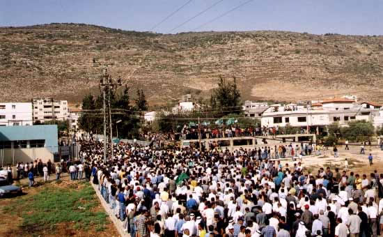
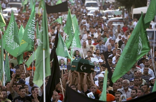
Posted by صقر الجليل - عشرات الالاف من المنداويين وضواحي كفر مندا في جنازة الشهيد احمد خطيب واعلام الحركه الاسلاميه ترفع
Posted by صقر الجليل - صور لتذكار الشهداء في مركز البلده

Posted by صقر الجليل - صوره نادره للبلده التقطت عام 2002

Posted by صقر الجليل - صوره اثناء جنازه لثلاثه من ابناء البلده قتلو في سيناء في حادثة انقلاب الباص

Posted by صقر الجليل - صوره لصرح الشهيد رامز بشناق الذي استشهد في معركة الاقصى

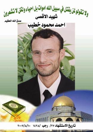
Posted by صقر الجليل - صوره رمزيه للشهيد احمد خطيب الذي استشهد قرب المسجد الاقصى في سنة 2007 م
Posted by صقر الجليل - صوره التقطت من الناحيه الغربيه للبلده

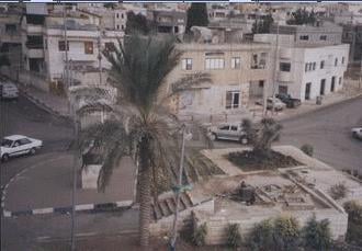
Posted by صقر الجليل - صوره داخل البلده

Posted by صقر الجليل - صوره التقطت للبلده من جبل الديدبه

Posted by صقر الجليل - صوره من الناحيه الشماليه للبلده القديمه

Posted by صقر الجليل - مغارة الاربعين في شمال كفر مندا يقان انه كان بختبأ فيها 40 يهودي اثناء الحرب

Posted by صقر الجليل 1 - سكان مندا يجهزون للاضاحي في عيد الاضحى المبارك

Posted by صقر الجليل - صوره داخل البلده

Posted by صقر الجليل - صوره في احدى حارات البلده

Posted by صقر الجليل - التجمع السكاني في البلده

Posted by صقر الجليل - صوره في احدى شوارع البلده

Posted by صقر الجليل - رئيس الحركه الاسلاميه في الداخل الفلسطيني يلقي خطابا امام عشرات الالوف من جماهير البلده

Posted by صقر الجليل - اهالي البلده يودعون احد شهدائها

Posted by صقر الجليل - صوره في احد احياء البلده

Posted by صقر الجليل - تنظيم الحركه الاسلاميه في مندا الجليل في مسيرة افتتاح المعسكر الاسلامي في البلده

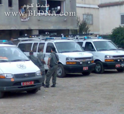
Posted by صقر الجليل - الامن الاسرائيلي يداهم منازل في مدينة كفر مندا بالجليل بحثا عن السلاح
Posted by صقر الجليل - عمليه تخريبيه في العياده الاسلاميه في كفر مندا

Posted by صقر الجليل - انفجار غريب داخل مدينة كفر مندا بالجليل

Posted by صقر الجليل - الرياح في كفر مندا تقلع الاشجار من جذوعها

Posted by صقر الجليل - نمور الجبال المنداويه للدراجات الهوائيه في مطله لسطوح مندا

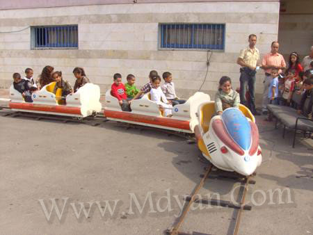
Posted by صقر الجليل - الاطفال في مدينة الملاهي بالبلده
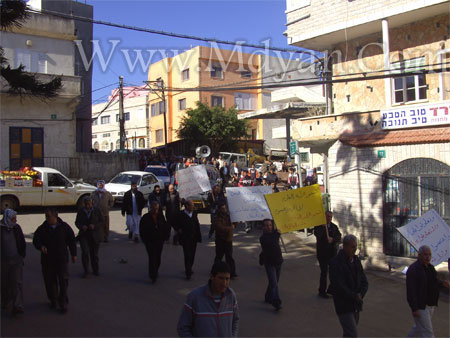
Posted by صقر الجليل - انطلاقات جماهير مندا للتعبير عن غضبهم لاحداث الشغب فيالمنداويه
Posted by صقر الجليل - صوره تبين جماهير منداويه في احتفال تابع للحركه الاسلاميه في ياحة العين

Posted by صقر الجليل - اطفال مندا يعبرون عن استنكارهم لاغتيال الاحتلال الاسرائيلي رامز بشناق

Posted by صقر الجليل - مهرجان حاشد في كفر مندا تابع للحركه الاسلاميه في داخل الاراضي المحتله

Posted by صقر الجليل - صوره تبين جماهير منداويه في احتفال تابع للحركه الاسلاميه في ساحة العين

Posted by صقر الجليل - الشيخ رائد صلاح يودع الشهيد الخطيب من كفر مندا
Posted by صقر الجليل - مندا الجليل تودع شهدائها

Posted by صقر الجليل - مندا الجليل تودع شهدائها 1

Posted by صقر الجليل - السلطات الاسرائيليه تهدم منازل في كفر مندا
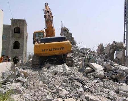
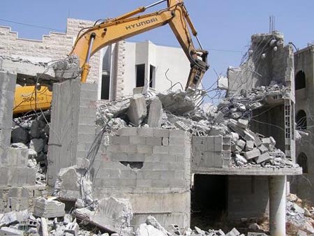
Posted by صقر الجليل - السلطات الاسرائيليه تواصل الهدم للمنازل في مندا الجليل
Posted by صقر الجليل - اطفال مؤسسة حراء لتحفيظ القرآنالمنداويه يقيمون الصلاة في احراش مندا

Posted by صقر الجليل - الاف الطلاب المنداويون في مسابقه تابعه لتنظيم الحركه الاسلاميه في قاعة التقوى في كفر مندا

Posted by صقر الجليل - اطفال مندا تحتفل بالزيت والزيتون في احياء تراث مندا القديم

Posted by صقر الجليل - افطار جماعي في رمضان في مدرسة ابن سينا في كفر مندا

Posted by صقر الجليل - الحركه الاسلاميه في كفر مندا تنظم يوم الفرقان 1

Posted by صقر الجليل - الحركه الاسلاميه في كفر مندا تنظم يوم الفرقان 2

Posted by صقر الجليل - الحركه الاسلاميه في كفر مندا تنظم يوم الفرقان 3

Posted by صقر الجليل - رئيس الحركه الاسلاميه في كفر مندا يلقي خطابا امام الاف الجماهير بسبب اعمال العنف المنداويه اواخر 2007

Posted by صقر الجليل - مسيرات حاشده لعشرات الجماهير في مدينة كفر مندا بالجليل بعد اعمال العنف اواخر سنة 2007

Posted by صقر الجليل - صوره ناتجه من اعمال الشغب المنداويه

Posted by صقر الجليل - الحركه الاسلاميه تتمسك بابناء الجيل القادم في كفر مندا لمئات الفعاليات

Posted by صقر الجليل - جماهير مندا تختم اسبوع الكتاب الاسلامي

Posted by صقر الجليل - المدخل القديم للبلده الشرقيه

Posted by صقر الجليل - اطفال مندا لمعسكر الحصاد بكاميرا بلدنا كوم

Posted by صقر الجليل 1 - كفر مندا من الداخل 1

Posted by صقر الجليل - كفر مندا من الداخل 2

Posted by صقر الجليل - ( بكاميرا الجليل العربي *j.k.m.a *) حي منداوي في سهل البطوف

Posted by صقر الجليل - ( بكاميرا الجليل العربي *j.k.m.a *) كفر مندا اسفل جبل الديدبه الجليلي

Posted by صقر الجليل - ( بكاميرا الجليل العربي *j.k.m.a *) الصبر في سهول مندا

Posted by صقر الجليل - ( بكاميرا الجليل العربي *j.k.m.a *) ثمار الصبر في كفر مندا

Posted by صقر الجليل 2 - ( بكاميرا الجليل العربي *j.k.m.a *) حي في داخل المنطقه الجنوبيه لمندا

Posted by صقر الجليل 1 - ( بكاميرا الجليل العربي *j.k.m.a *) صوره في جوف مندا بعد الغروب

Posted by صقر الجليل - ( بكاميرا الجليل العربي *j.k.m.a *) صوره قرب عين مندا

Posted by صقر الجليل - منظر عام

- منظر عام

- مفحمة في كفر مندا سنة 1956

- Pre-Nakba Aerial view of the village / صورة من الجو للقرية اخذت قبل النكبة
- خارطة تُظهِر الحدود والطرق بأنواعها والأماكن المقدسة والطبيعة الطوبغرافية من تلال وسهول ومنحدرات والتشكيلة الطبيعية للأرض وأنواع المزروعات. نُشرت الخريطة فترة الانتداب البريطاني، تم إضافة تعديلات عليها من قِبَل خدمة الخرائط والصور التابعة للقوات العسكرية الاسرائيلية فترة الأربعينيات.

- شهادة هوية مرعي سعيد القدح - كفرمندا -- المزيد في قسم التعليقات

1 - شهادة هوية طه الأحمد –كفر مندا -- المزيد في قسم التعليقات

1 - نقل المعلم عبدالواحد يونس الخطيبن من مدرسة كفرمندا الى مدرسة صفورية - حيفا -تاريخ الوثيقة:
12/08/1943

Want to browse more? 80,000 pictures were grouped in these gallaries:
- جنازة شهيد الانتفاضه رامز بشناق
Posted by نجوى - عشرات الالاف من المنداويين وضواحي كفر مندا في جنازة الشهيد احمد خطيب واعلام الحركه الاسلاميه ترفع
Posted by صقر الجليل - صوره اثناء جنازه لثلاثه من ابناء البلده قتلو في سيناء في حادثة انقلاب الباص
Posted by صقر الجليل - صوره لصرح الشهيد رامز بشناق الذي استشهد في معركة الاقصى
Posted by صقر الجليل - صوره رمزيه للشهيد احمد خطيب الذي استشهد قرب المسجد الاقصى في سنة 2007 م
Posted by صقر الجليل - رئيس الحركه الاسلاميه في الداخل الفلسطيني يلقي خطابا امام عشرات الالوف من جماهير البلده
Posted by صقر الجليل
| Display Name | Clan/Hamolah | Country of Residence |
| خالد | زيدان | كفر مندا فلسطين 48 |
| حنين فلسطين | الحايك | - |
- حكاية بلد-- قرية كفر مندا Duration: 23 min 7 sec
No links have been shared yet, be free to the first to share the first link.
 Fake Valor: Why Did Zionist Jews Hoist Nazis Flag on Their Ships in the 1930s?
What is new?
-
Facts About Oct. 7th Gaza Raid
-
Remined Us Please: Who Did Rape Whom? Was it Palestinians who raped Israelis? Or, was the other way around? You'll be the judge
-
When Prof. Edward Said was invited to debate Bibi Netanyahu in the 1980s, watch what happened!
-
Ezra Klein of the NY Times on the "Jewish Race".
-
Abusing Blood Libel!
-
How and why Israeli Jewry has become the most hated cult?
-
Did Israeli Soldiers Activate The Hannibal Direective On Oct. 7th? You Be The Judge
-
Zionist FAQ: Isn't it true that Palestinians don't want peace? Palestinians never accepted the two-state solution
- Facts about Haavara (Transfer) Agreement between Ben-Gurion & Hitler
-
Haavara FAQs: Why Did Zionist Jews Hoist Nazis' Flags on Their Ships in the 1930s?
- Haavara FAQs: When Chaim Weizmann met FDR in mid-1943, why was he silent about rescuing European Jewry?
-
Dear ChatGPT: How did Palestinians resist Napoleon's invasion of their country in 1799?
-
Dear ChatGPT: Gaza had a vibrant Jewish community in the mid-17th century. What happened to them?
-
Dear ChatGPT: Why did the Jewish Agency suppress news of the Holocaust during WWII?
-
Video Playlist: Jews share their DNA tests to end the conflict for good.
-
A Tale of Two Conflicts: Examining the Definition of Genocide
-
Prof. Abraham Polak And The Suppressed History of the Khazars and European Jewry
-
How Ronald Reagan would have framed the genocide in Gaza if he were still alive?
-
Haavara FAQs: Let us do the math: how many German Jews did The Haavara Agreement save?
-
Zionist FAQs: The Hebron Massacre of 1929, "clearly proves" that Palestinians are antisemitic, how could you deny it?
-
Zionist FAQs: Why Anti-Zionist Is Not Antisemitism?
-
Zionist FAQs: Isn't it true that the KGB created Palestinian Nationalism in the early 1960s?
- Zionist FAQs: Muslims are killing Muslims all the time; why are Israeli Jews being singled out in the media?
- Zionist FAQs: How is Israel an apartheid state when 20% of its citizens are Arabs who enjoy full rights?
-
Haavara FAQs: Why Did Dorothy Thompson Flip From A Zionist Advocate to A Silenced Dissenter?
-
Haavara FAQs: Analysis of Herzl's Uganda Scheme and how it could have saved millions of Jews.
-
Haavara FAQs: Why did Hayim Greenberg describe American Jewry as "morally bankrupt" in early 1943?
-
Haavara FAQs: What if the Evian Conference was a resounding success? What would have been the impact of saving European Jewry on Zionism?
- Haavara FAQs: What if the six million were saved, how that would have impacted the Zionist project?
-
Haavara FAQs: How did Zionist leaders react when Europe's Jews lingered in the DP camps after WWII ended?
-
Why does the American Jewish community repeat lies that David Ben-Gurion had debunked before he died?
-
Who has the power to rename the Tatar/Khazar Gene Marker to Jewish IV?
-
Zionist FAQs: Why won't Egypt, Syria, and Jordan take their people back? Jews are indigenous to Palestine, and Arabs immigrated after Jews developed the country. Arabs should leave.
-
Haavara FAQs: Did Hitler and the Nazis conflate between Judaism and Zionist? If that wasn't case, then why?
-
Haavara FAQs: Winston Churchill and antisemitism, a collection of articles written Churchill.
-
Haavara FAQs: Broken by country, how many Jews survived vs. killed during the Holocaust?
-
Haavara FAQs: Why did European Jews vote with their feet and to immigrated to the Americas, not Palestine, after WWII?
-
Watch this American Jewish Girl describing Israeli Jews' cognitive dissonance like no other in under two minutes
-
Haavara FAQs: When the Nazis went out of their way to hide the Holocaust, Israeli Jews did the exact opposite by broadcasting their genocide of Gazans. But why?
-
Haavara FAQs: How Zionist Jews went out of their to show their appreciation to Nazism and Fascism?
- Haavara FAQs: Why Zionist leaders were against bombing the death camps & the Railroads leading to them?
-
Haavara FAQs: Hitler's message to the British and American people: If Jews are such noble citizens and you care about them, how come you're not letting them in? I will gladly ship them to you at my expense, even on luxury liners!
-
A shortlist of Zionist and Israeli false flag operations in the name Jews.
-
The Most Moral Army
- The Land of Kapos (Israel): Where the brave are boycotted and Kapos walk free.
- Why did early Zionists often named their communal enterprises "colonial"?
- Zionist Relations with Nazi Germany by Faris Glubb
-
Two NY Times advertisements by Zionists in the early 1943 that exposes Zionists' treason at the height of the calamity
- Facts Not Lies about the Palestinian-Israeli Conflict.
- Site's pictures have been categorized
- Campgain Against Lice
- A Survey of Palestine, the official source about Palestine before Nakba produced by the British Mandate; over 1200 pages.
- Satellite View & Google Earth: Over 6,000 placemarks identifying all destroyed towns, W. Bank & Gaza Strip Towns, & refugee camps.
- PalestineRemembered.com and its Nakba Oral History Project were featured on al-Jazeera Satellite TV.
- Nakba Oral History Video Podcast:
 Over 700 Oral History interviews (including 3,500+ hours of recording) can be viewed online.
 - Palestine Village Statistics Project
- Gaza Jail Break
- النسخة العربية للموقع الان متوفرة
- Videos: Documenting the destroyed villages in video: Tracing all that remains since Nakba.
- Videos: Responding to Zionist Propaganda
- Interview: The ethnic cleansing of Palestine: George Galloway interviews Israeli Historian Ilan Pappe.
- For Palestinians, memory matters. It provides a blueprint for their future By George Bisharat.
- Zionist FAQ now available in Hebrew שאלות שציונים שואלים, עכשיו בעברית
- Video: The Stephen Walt and John Mearsheimer report on the influence of the Israel Lobby on U.S. Foreign Policy
- The Palestinian-Israeli conflict for beginners
