| PalestineRemembered | About Us | Oral History | العربية | |
| Pictures | Zionist FAQs | Haavara | Maps | |
| Search |
| Camps |
| Districts |
| Acre |
| Baysan |
| Beersheba |
| Bethlehem |
| Gaza |
| Haifa |
| Hebron |
| Jaffa |
| Jericho |
| Jerusalem |
| Jinin |
| Nablus |
| Nazareth |
| Ramallah |
| al-Ramla |
| Safad |
| Tiberias |
| Tulkarm |
| Donate |
| Contact |
| Profile |
| Videos |
Welcome To 'Aynabus - عينابوس (עינאבוס)
|
District of Nablus
Occupied days ago |
العربية Google Earth |
 |
Gallery (150) |
- Statistics & Facts
-
Before & After

- Satellite View
- Articles 10
- Pictures 150
- Mayrters & Prisoners 1
- Members 15
- Families
- Wikipedia
- ARIJ Guide
- Videos 1
- Guest Book 8
- Links
| Statistic & Fact | Value | ||||||||||||||||||||
| Distance From District | 11 km southwest of Nablus | ||||||||||||||||||||
| Elevation | 503 meters | ||||||||||||||||||||
| Before & After Nakba, Click Map For Details |
|||||||||||||||||||||

|
|||||||||||||||||||||
| Land Ownership |
**Town Lands' Demarcation Maps |
||||||||||||||||||||
| Land Usage As of 1945 |
|
||||||||||||||||||||
| Population |
|
||||||||||||||||||||
| Near By Towns |
|||||||||||||||||||||
|
|||||||||||||||||||||
| Featured Video | |||||||||||||||||||||
| ARIJ Guide | |||||||||||||||||||||
3.

4. 
5. 
6. 
7. 
8. 
9. 
10. 
11. 
12. 
13. 
14. 
15. 
16. 
17. 
18. 
19. 
Click here to browse online. |
|||||||||||||||||||||
| Related Maps | Town Lands' Demarcation Maps خرائط للقضاء توضح حدود القرى والاودية View from satellite Town's map on MapQuest Help us map this town at WikiMapia |
||||||||||||||||||||
| Related Links | Wikipedia's Page Facebook Page ARIJ Guide Google Search Google For Images Google For Videos في كتاب بلادنا فلسطين دليل أريج المزيد من موقع هوية |
||||||||||||||||||||
- مقالات ادبية بقلم الكاتب باسم شتيوي العينبوسي
- مقالة ادبية بعنوان (الا ليتها لم تتخلق ) بقلم الكاتب والفنان باسم شتيوي العينبوسي اضافة جلال حمد
- مقالة ادبية بعنوان (رسائل ومجيب) بقلم الكاتب والفنان باسم شتيوي العينبوسي اضافة جلال حمد
- مقالة ادبية بعنوان ( أيات قاهرات ) بقلم الكاتب والفنان باسم شتيوي العينبوسي اضافة جلال حمد
- مقالة ادبية بعنوان ( ضياع ) بقلم الكاتب والفنان باسم شتيوي العينبوسي اضافة جلال حمد
- قصيدة إلى عينبوس - قصيدة مهداة إلى عينبوس واهلها من زياد علان في المهجر
- ايها القادة.. لا تتحدثوا باسمنا!
- رمضان ألفى
- جزء من قصيدة عن المرحوم الحاج نجم محمد بدوي الملقب ب نجم عينابوس - بقلم عبد الرحمان أدريس بدوي
- مديح عن الحاج محمود بدوي محمد بدوي - بقلم عبد الرحمن أدريس بدوي
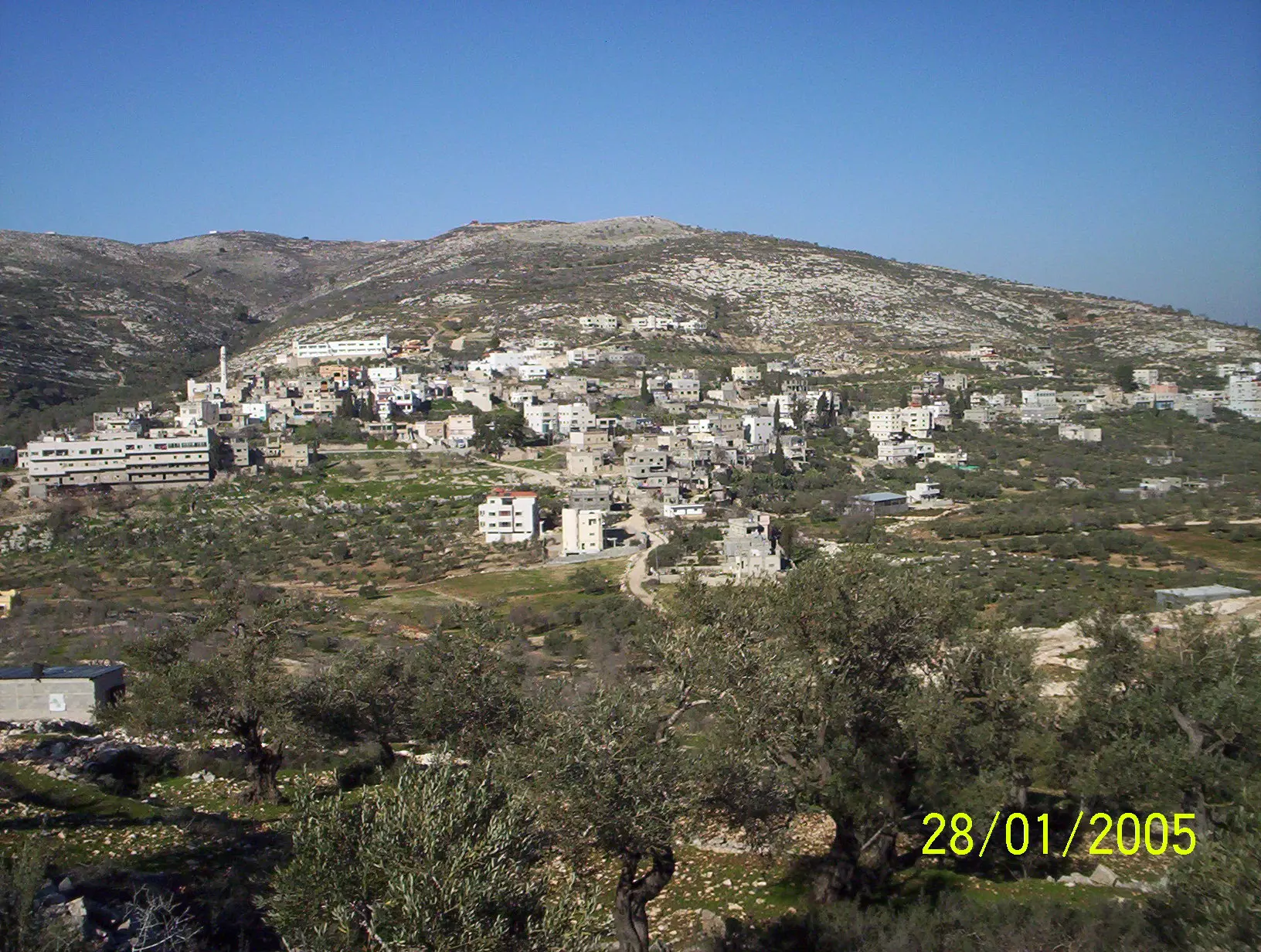
- General View
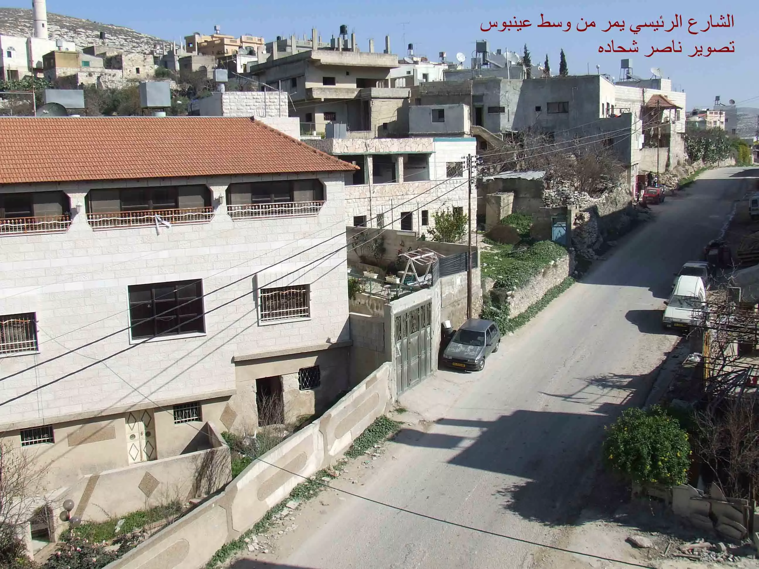
Posted by Mach Abdel 5 - الشارع الرئيسي في عينبوس تصوير ناصر شحاده
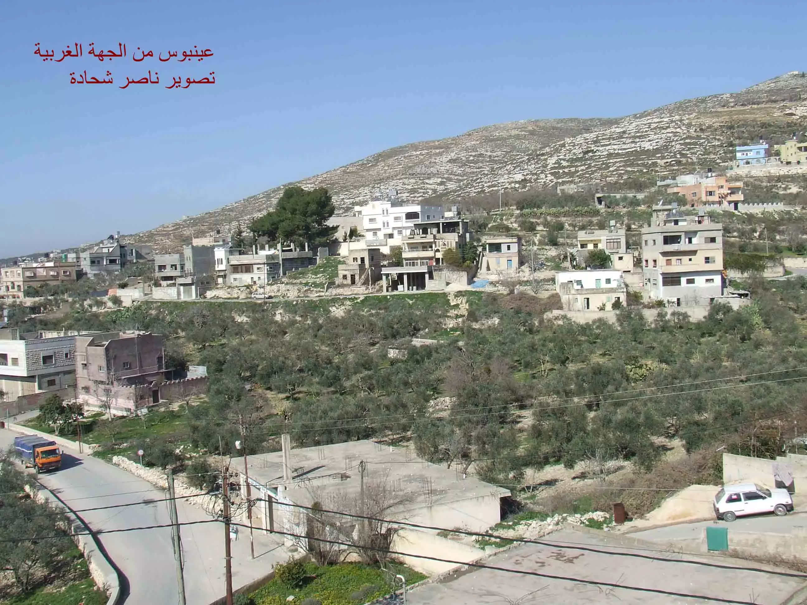
Posted by naser abed - الحارة الغربية حارة الجسرعينبوس تصوير ناصر شحاده
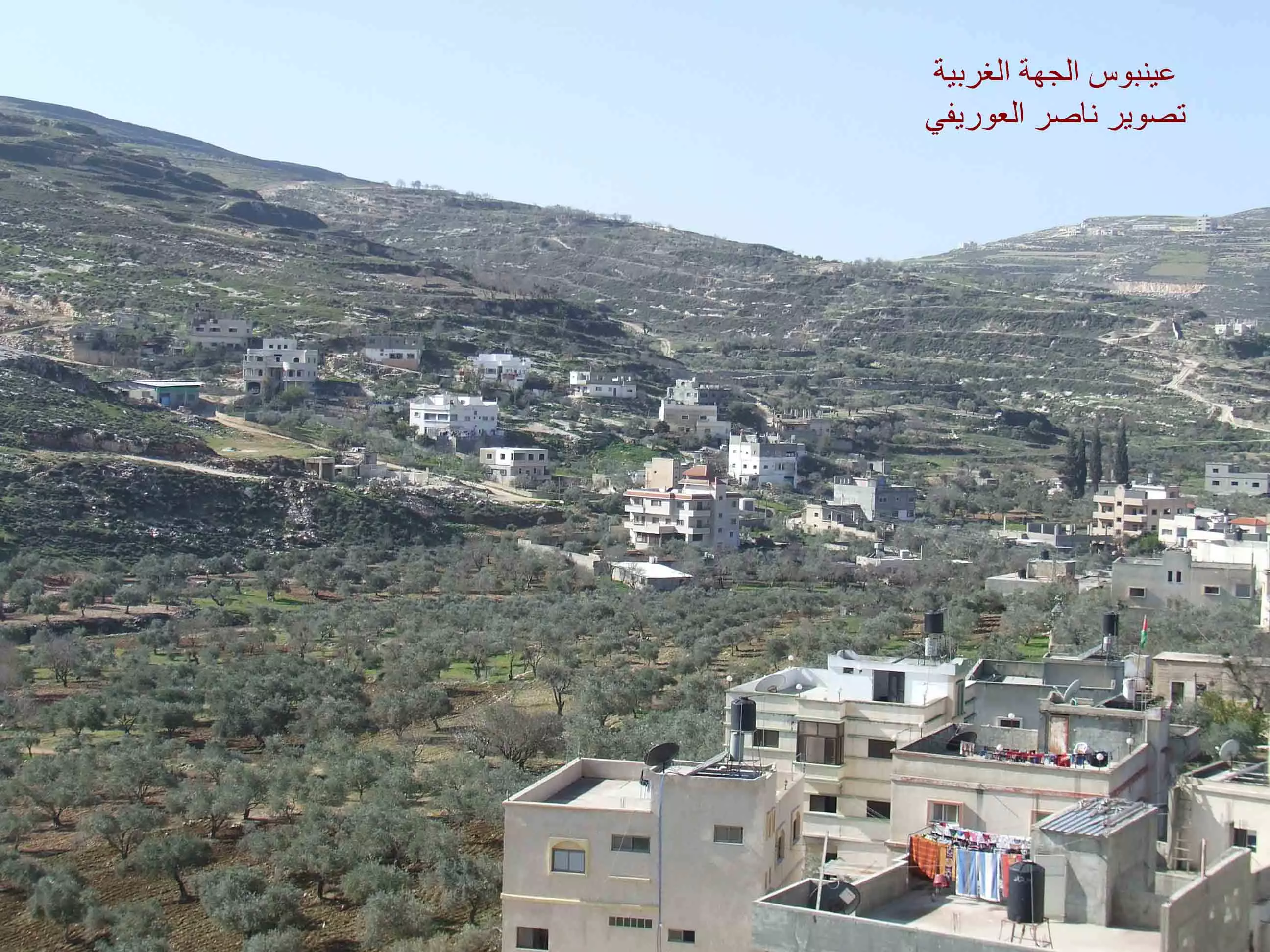
Posted by naser abed - الحارة الغربية الشمالية عينبوس تصوير ناصر شحاده
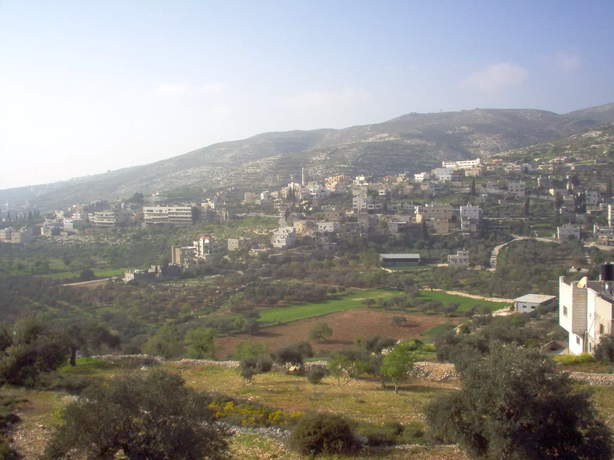
Posted by naser abed - منظر عام، اُنقر الصورة لتكبيرها
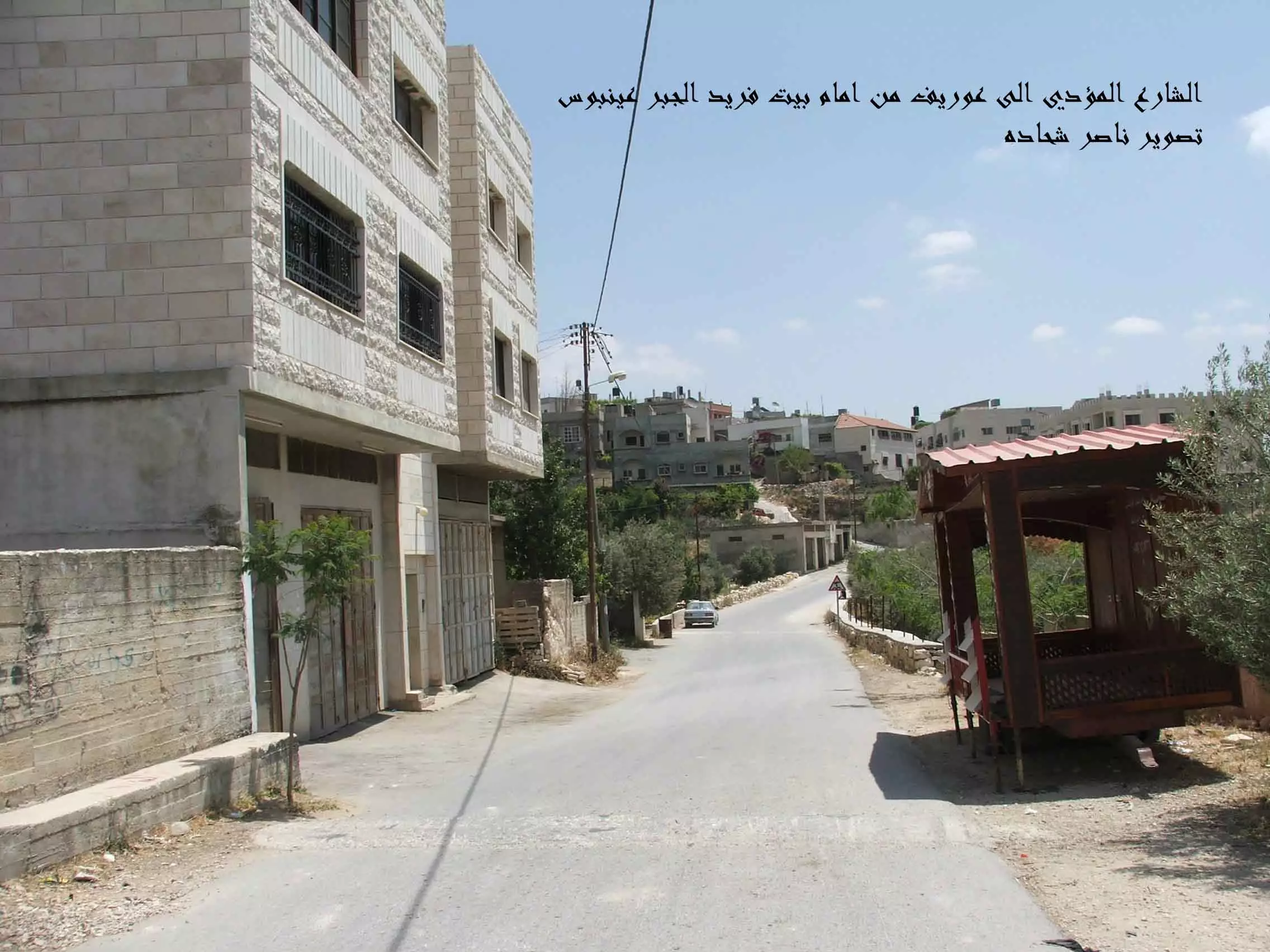
1 - شارع عوريف عينبوس تصوير ناصر شحاده عوريف
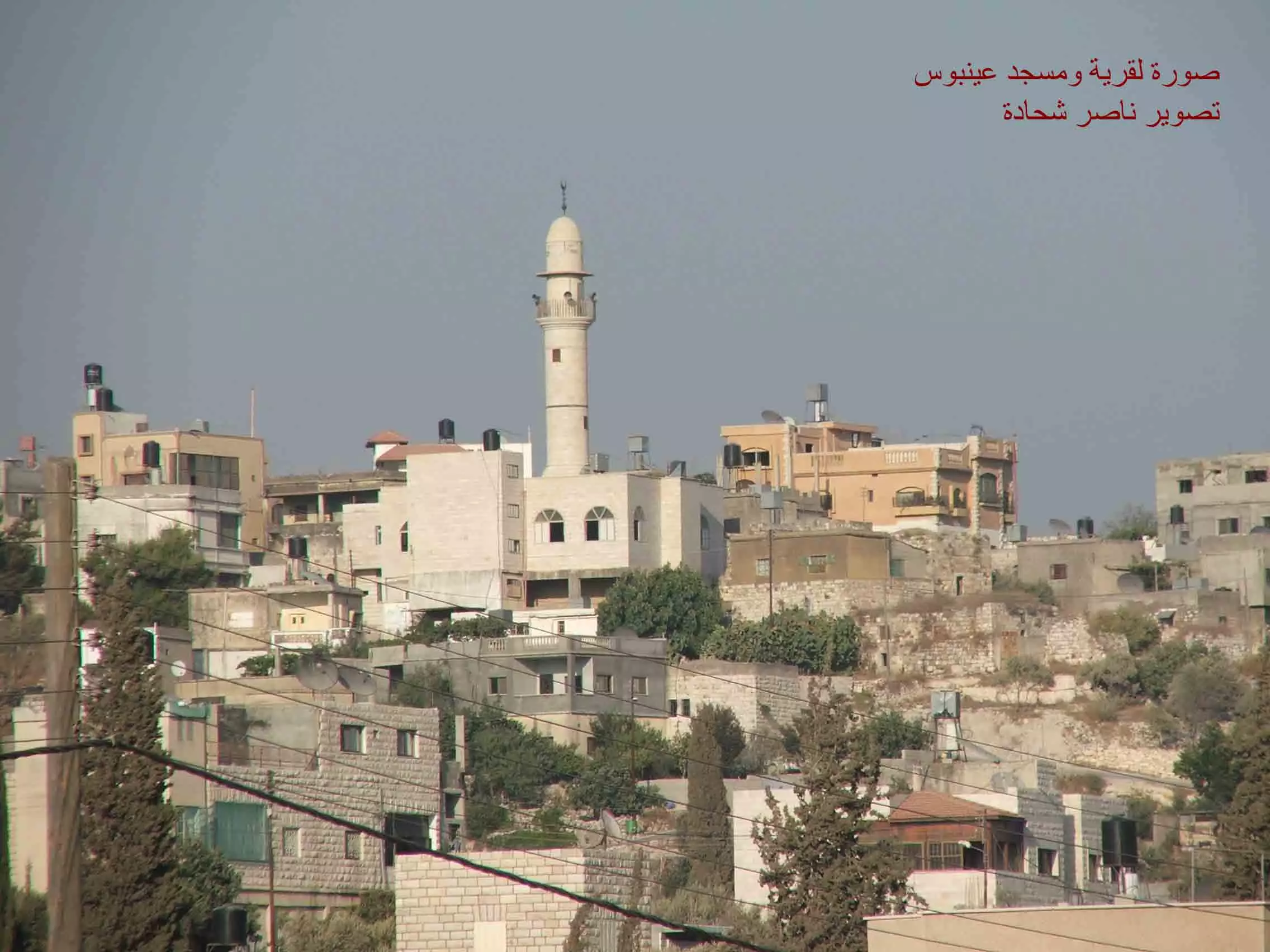
Posted by naser abed - مئذنة ومسجد عينبوس وسط البلد تصوير ناصر شحاده
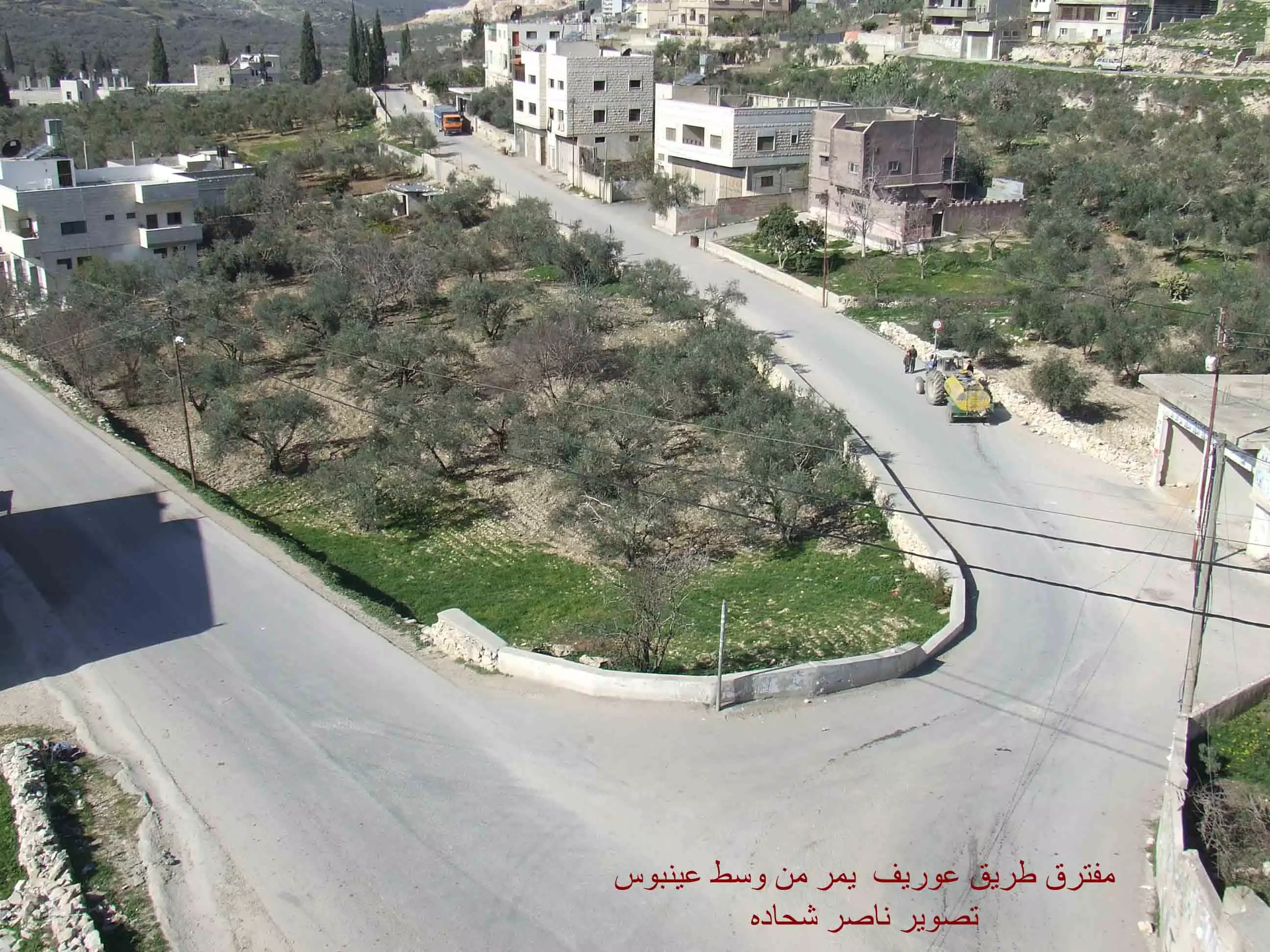
Posted by naser abed - مفرق عوريف- وسط عينبوس ويظهر اطراف عينبوس تصوير ناصر شحاده
Posted by naser abed 4 - واد عينابوس تصوير ناصر شحاده

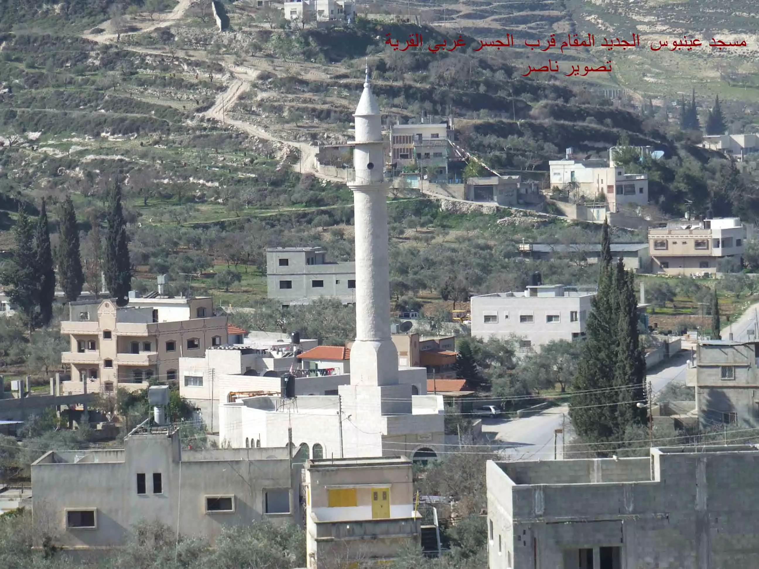
Posted by naser abed 1 - مسجد الغربي الجديد في عينابوس تصوير ناصر شحاده
Posted by naser abed - صورة مدرسة بنات عينابوس ومدرسة ذكور عينابوس

Posted by جلال عايد - صورة جبل عطارد

Posted by جلال عايد 1 - والد طايل وصايل تصوير ناصر شحاده عوريف 0507559901

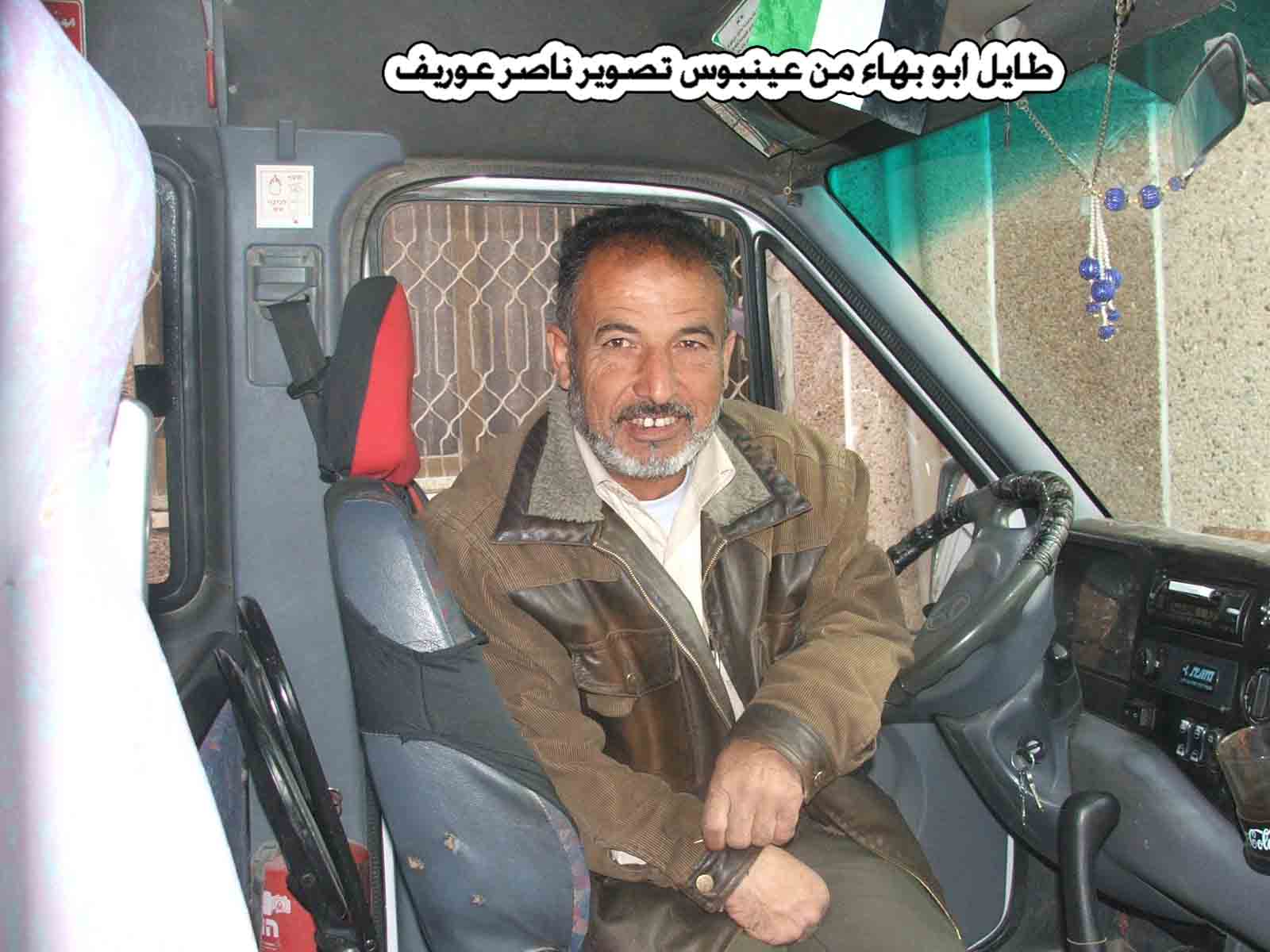
Posted by naser abed - طايل ابو بهاء تصوير ناصر شحاده عوريف 0507559901
Posted by naser abed - المرحومين ابو احمد الدعاس وزوجته وفيقه عبد الرحمن تصوير ناصر عوريف 0507559901

Posted by naser abed - مسجد عينابوس القديم تصوير جلال حمد

Posted by جلال عايد 4 - بعض الثلوج على جبال عينابوس تصوير جلال حمد

Posted by جلال عايد - سوبر ماركت الزعيم على الشارع الرئيسي لي عينابوس تصوير جلال حمد

Posted by جلال عايد - مسجد السبيل تصوير جلال حمد

Posted by جلال عايد - الشارع الرئيسي الذي يمر وسط قرية عينابوس تصوير جلال حمد

Posted by جلال عايد - منظر عام

Posted by bassem badawi - منظر عام

Posted by bassem badawi - منظر عام

Posted by bassem badawi 1 - سوبر ماركت الزعيم في وسط عينابوس على الشارع الرئيسي تصوير جلال حمد

Posted by جلال عايد 1 - ابو رياض حمد الله العبد تصوير ناصر شحاده عوريف

Posted by naser abed 1 - الشيخ ابو درغام خطيب وامام مسجد عينبوس تصوير ناصر شحاده عوريف

Posted by naser abed - ابو ايمن المختار عينبوس تصوير ناصر شحاده عوريف

Posted by naser abed - عرس شادي الجماعيني تصوير ناصر شحاده عوريف 0598549864

Posted by naser abed - عرس شادي الجماعيني تصوير ناصر شحاده عوريف 0598549864

Posted by naser abed - عرس شادي الجماعيني تصوير ناصر شحاده عوريف 0598549864

Posted by naser abed - عرس شادي الجماعيني تصوير ناصر شحاده عوريف 0598549864

Posted by naser abed 1 - مختار عينبوس ابو يوسف تصوير ناصر شحاده عوريف0598549864

Posted by naser abed 1 - الحاج داود موسي الريان واولاده المهندس سيف والسيد ريان من ابناء عينابوس بالخارج

Posted by ريان 1 - عينابوس من الشرق تصوير جلال حمد 0525274271

Posted by جلال عايد 1 - صورة لي عينابوس وتظهر القرى المجاورة لها تصزير جلال حمد 0525274271

Posted by جلال عايد - عينابوس زفة العريس محمد احمد رشدان ابو حلاوه تصوير يوسف حسن عوده

Posted by يوسف عوده 2 - شباب عينابوس في زفة العريس تصوير يوسف حسن عوده

Posted by يوسف عوده - عينبوس في الثلج

Posted by العينبوسي - منظر عام قرية عينابوس تصوير يوسف حسن عوده

Posted by يوسف عوده 1 - منظر عام قرية عينابوس تصوير يوسف حسن عوده

Posted by يوسف عوده - الزجال ابو حسن العينبوسي

Posted by يوسف عوده 2 - مجموعه من كبار السن من تصويري....... يوسف

Posted by يوسف عوده - ماضي الصابر ابو راضي من تصويري....... يوسف

Posted by يوسف عوده 1 - منظر عام لقرية حواره من جهة المسبح من تصويري....... يوسف

Posted by يوسف عوده - ابو محمود نافذ رشدان رئيس مجلس عينابوس في زفة العريس من تصويري

Posted by يوسف عوده 2 - ابو محمود نافذ رشدان رئيس مجلس عينابوس في زفة العريس من تصويري .... يوسف

Posted by يوسف عوده - السيد صبري فهد شيخ الشباب من تصويري .... يوسف

Posted by يوسف عوده 1 - ابو محفوظ محمد السعيد احد كبار المعمرين في القريه من تصويري.......يوسف

Posted by يوسف عوده - الاستاذ عبد الكريم يوسف رشدان ابو يوسف

Posted by يوسف عوده 2 - مجموعه من كبار السن

Posted by يوسف عوده 1 - الاستاذ ابو رياض يتناول طعام الغداء في احد اعراس القريه

Posted by يوسف عوده - عن جبل عطارود ساريسا وعوريف تصور عبدالله العينبوسي

Posted by العينبوسي - مسجد الاربعين شهيد (المسجد القديم ) تصوير عبدالله ربحي حمد

Posted by عبد الله حمد - صورة عامة لقرية عينابوس

Posted by عبد الله حمد 1 - مجموعه من شباب القريه امام مقهى حسام ابو سعده تصوير يوسف عوده

Posted by يوسف عوده - الزيتون الرومي في عينابوس تاريخ وتراث

Posted by يوسف عوده - الزيتون الرومي في عينابوس تاريخ وتراث.... تصوير يوسف عوده

Posted by يوسف عوده - الحاج علي ابو يعقوب اكبر معمر في القريه تصوير ......... يوسف عوده

Posted by يوسف عوده 2 - منظر لجبل عطارود جنوب عينبوس - تصوير معتز علان ٥/٨/٢٠٠٨

Posted by Mutaz Allan 1 - شباب القريه في احد الاعراس تصوير ...... يوسف عوده

Posted by يوسف عوده - مجموعه من الشباب في احد الاعراس تصوير ...... يوسف عوده

Posted by يوسف عوده - مجموعه من الشباب يشاركون في عرس بهاء طايل تصوير ...... يوسف عوده

Posted by يوسف عوده 1 - عرس بهاء الطايل ...... يوسف عوده

Posted by يوسف عوده - عرس بهاء الطايل ...... يوسف عوده

Posted by يوسف عوده 1 - عرس بهاء الطايـل

Posted by يوسف عوده - افراح عينابوس ومشاركة شباب القريه

Posted by يوسف عوده - العريس بهاء الطايل

Posted by يوسف عوده 1 - اهالي البلد في زفة العريس ......تصوير يوسف عوده

Posted by يوسف عوده 1 - اهالي البلد في زفة العريس ......تصوير يوسف عوده

Posted by يوسف عوده 1 - اهالي البلد في زفة العريس ......تصوير يوسف عوده

Posted by يوسف عوده - اهالي البلد في زفة العريس ......تصوير يوسف عوده

Posted by يوسف عوده 1 - مجموعه من اهالي القريه في زفة العريس ......تصوير يوسف عوده

Posted by يوسف عوده - مجموعه من اهالي القريه في زفة العريس ......تصوير يوسف عوده

Posted by يوسف عوده - في زفة بهاء الطايل..... تصوير يوسف عوده

Posted by يوسف عوده - منظر طبيعي منطقة الزانوك صنوبرات ابو الشقور...... تصوير يوسف عوده

Posted by يوسف عوده - منظر من فصل الربيع

Posted by Ghanem Mustafa - عينابوس حفلة مالك صوفان

Posted by رامي حسين - موسم قطف الزيتون في القريه

Posted by يوسف عوده - موسم قطف الزيتون في القريه تصوير ..... يوسف عوده

Posted by يوسف عوده - احدا كبار السن في عينابوس ابو عايد وابو نزام في احد الاعراس في القرية

Posted by جلال عايد - general view

Posted by bassem badawi 1 - general view

Posted by bassem badawi - المرحوم..... عاطف ابو فريد يحرث الارض .... تصوير يوسف عوده

Posted by يوسف عوده - صوره لما تبقى من بعض البيوت القديمه في القريه

Posted by يوسف عوده - سوبر ماركت طارق وسط القريه تصوير ............ يوسف عوده

Posted by يوسف عوده 1 - بعض البيوت القديمه في القريه تصوير.................. يوسف عوده

Posted by يوسف عوده 1 - البيوت القديمه في القريه ......... تصوير يوسف عوده

Posted by يوسف عوده - جنازة مختار عينابوس ابو يوسف رحمة الله2009/2/1 **تصوير جلال حمد ---انا لله وانا الية راجعون

Posted by جلال عايد - جنازة مختار عينابوس ابو يوسف رحمة الله2009/2/1 ***تصوير جلال حمد ---انا لله وانا الية راجعون

Posted by جلال عايد - جنازة المرحوم ابو يوسف مختارقرية عينابوس عليه رحمة الله ....... تصوير يوسف عوده

Posted by يوسف عوده - اهالي عينابوس في جنازة المختار ابو يوسف....... تصوير يوسف عوده

Posted by يوسف عوده - حسن فايز ميلادي ابو ميلادي من المعمرين في القريه....... تصوير يوسف عوده

Posted by يوسف عوده 1 - صور أعادة تاهيل شبكة مياه قرية عينابوس من ( السفارة اليابانية ) تصوير جلال حمد

Posted by جلال عايد - صور أعادة تاهيل شبكة مياه قرية عينابوس من ( السفارة اليابانية ) تصوير جلال حمد

Posted by جلال عايد - صور أعادة تاهيل شبكة مياه قرية عينابوس من ( السفارة اليابانية ) تصوير جلال حمد

Posted by جلال عايد - صور أعادة تاهيل شبكة مياه قرية عينابوس من ( السفارة اليابانية ) تصوير جلال حمد

Posted by جلال عايد - صور أعادة تاهيل شبكة مياه قرية عينابوس من ( السفارة اليابانية ) تصوير جلال حمد

Posted by جلال عايد - صور أعادة تاهيل شبكة مياه قرية عينابوس من ( السفارة اليابانية ) تصوير جلال حمد

Posted by جلال عايد - صور أعادة تاهيل شبكة مياه قرية عينابوس من ( السفارة اليابانية ) تصوير جلال حمد

Posted by جلال عايد - صور أعادة تاهيل شبكة مياه قرية عينابوس من ( السفارة اليابانية ) تصوير جلال حمد

Posted by جلال عايد - صور أعادة تاهيل شبكة مياه قرية عينابوس من ( السفارة اليابانية ) تصوير جلال حمد

Posted by جلال عايد - صور أعادة تاهيل شبكة مياه قرية عينابوس من ( السفارة اليابانية ) تصوير جلال حمد

Posted by جلال عايد - صور أعادة تاهيل شبكة مياه قرية عينابوس من ( السفارة اليابانية ) تصوير جلال حمد

Posted by جلال عايد - صور أعادة تاهيل شبكة مياه قرية عينابوس من ( السفارة اليابانية ) تصوير جلال حمد

Posted by جلال عايد - صور أعادة تاهيل شبكة مياه قرية عينابوس من ( السفارة اليابانية ) تصوير جلال حمد

Posted by جلال عايد - صور أعادة تاهيل شبكة مياه قرية عينابوس من ( السفارة اليابانية ) تصوير جلال حمد

Posted by جلال عايد - صور أعادة تاهيل شبكة مياه قرية عينابوس من ( السفارة اليابانية ) تصوير جلال حمد

Posted by جلال عايد - صور أعادة تاهيل شبكة مياه قرية عينابوس من ( السفارة اليابانية ) تصوير جلال حمد

Posted by جلال عايد - صور أعادة تاهيل شبكة مياه قرية عينابوس من ( السفارة اليابانية ) تصوير جلال حمد

Posted by جلال عايد - صور أعادة تاهيل شبكة مياه قرية عينابوس من ( السفارة اليابانية ) تصوير جلال حمد

Posted by جلال عايد - صور أعادة تاهيل شبكة مياه قرية عينابوس من ( السفارة اليابانية ) تصوير جلال حمد

Posted by جلال عايد - مجموعه من شباب القريه في صوره تذكاريه في عام 1993 ويبدو في الصوره المرحوم فتوح عوده ابو محمد عليه رحمة الله تصوير .......يوسف عوده

Posted by يوسف عوده 1 - مصطفى احمد ابو خالد احد كبار السن في القريه............. تصوير يوسف عوده

Posted by يوسف عوده - من الطبيعه طائر الشنار داخل العش تصوير ................... يوسف عوده

Posted by يوسف عوده - صوره رائعه لعش الشنار................... يوسف عوده

Posted by يوسف عوده - صوره رائعه لعش احدى الطيور ................... يوسف عوده

Posted by يوسف عوده - صوره من الطبيعه الرائعه المحيطه في عينابوس تصوير ............... يوسف عوده

Posted by يوسف عوده 1 - صوره من الطبيعه الرائعه المحيطه في عينابوس تصوير ............... يوسف عوده

Posted by يوسف عوده - منظر عام للطبيعه في فصل الربيع منطقة خلة الزانه تصوير ..............يوسف عوده

Posted by يوسف عوده - منظر عام منطقة خلة الزانه ( عراق ابو عمرو ) تصوير ..............يوسف عوده

Posted by يوسف عوده - منظر عام فصل الربيع( مغارة خلة الزانه) تصوير ..............يوسف عوده

Posted by يوسف عوده 1 - صوره عن قرب لبير قويدر منطقه الصفحه تصوير ..............يوسف عوده

Posted by يوسف عوده - صوره لعينابوس من منطقه بير قويدر في الصفحه تصوير ..............يوسف عوده

Posted by يوسف عوده - واحد وستون عاما على النكبة تصميم عبد الله حمد

Posted by عبد الله حمد - صور من حفلة عوض الرشيد يظهر في الصورة ابو نادر و مشهور اللطفي و رفعت السلمان و ابو عامر تصوير جلال حمد

Posted by جلال عايد - شباب عينابوس في حفلة السهرة للعريس عوض تصوير جلال حمد

Posted by جلال عايد - صورة للمطرب والفرقة الموسيقية في عرس عوض الرشيد تصوير جلال حمد

Posted by جلال عايد - صورة لوالد العريس ابو عوض وعم العريس سرحان واخوة العريس عاصم ومحمد تصوير جلال حمد

Posted by جلال عايد - صورة لشجرة عائلة ال رشدان موجوده بمنزل جاد الكريم رشدان

Posted by يوسف 1 - من البيوت القديمه والجميله في عينابوس ............... تصوير يوسف حسن عوده

Posted by يوسف عوده - من البيوت القديمه والجميله في عينابوس ............... تصوير يوسف حسن عوده

Posted by يوسف عوده - باص الشتيوي عندما كان يعمل على خط عوريف الله يرحمو تصميم ناصر شحاده عوريف

Posted by naser abed 2 - افراح عينابوس ........... تصوير يوسف حسن عوده

Posted by يوسف عوده - افراح عينابوس ........... تصوير يوسف حسن عوده

Posted by يوسف عوده - افراح عينابوس ........... زفة العريس حسن كايد عوده تصوير يوسف حسن عوده

Posted by يوسف عوده 1 - شباب عينابوس زفة العريس حسن كايد عوده........ تصوير يوسف حسن عوده

Posted by يوسف عوده - الشهيد ساهر عبد الكريم19\1\2005

Posted by رامي حسين - الدكتور نصر الدين ابو مثير في اللباس العربي ........... تصوير يوسف عوده

Posted by يوسف عوده - عينابوس الشارع الرئيسي بعد اعمال التعبيد........... تصوير يوسف عوده

Posted by يوسف عوده - منزل المرحوم الحاج نجم محمد البدوي

Posted by Amer Hashim Badwi 1 - منزل المرحوم الحاج نجم محمد البدوي

Posted by Amer Hashim Badwi - منزل المرحوم الحاج نجم محمد البدوي

Posted by Amer Hashim Badwi 1 - منزل المرحوم الحاج نجم محمد البدوي

Posted by Amer Hashim Badwi - اياب نايف حمد

Posted by اياب - الفنان نادر صايل

Posted by العينابوسي - الفنان نادر صايل

Posted by العينابوسي - عينابوس الخضراء

Posted by محمد درويش - منظر عام

- منظر عام

- In the front, beneath the telephone cable, is Mount 725, an illegal Israeli colonial outpost of Yitzhar. Beneath it, crossed by the telephone cable, is Einabus. Covering most of the farther area is the municipality of Qabalan. Behind the right side of Qabalan is Talfit, and behind it is Qaryut. Behind the middle of Qabalan is Ahijah. Click the image to enlarge it

Want to browse more? 80,000 pictures were grouped in these gallaries:
| Display Name | Clan/Hamolah | Country of Residence |
| اخطبوط | - | - |
| الفتحاوي الاسود | - | - |
| اياب | حمد | نابلس |
| Amer Hashim Badwi | Badwi | Zarqa', Az Zarqa |
| محمد العينبوسي | - | - |
| bassem badawi | - | - |
| زياد علان العينبوسي | علان | نيويورك, USA |
| العينبوسي | حسين | ******, عينبوس |
| Mutaz Allan | Allan | CA, USA |
| ريان | rayyan | - |
| يوسف عوده | عوده | نابلس, عينابوس |
| kayed hamad | حمد | الشرقيه , السعوديه |
| Sam | ALLAN | ca, USA |
| جلال عايد | hamad | ainabus, palistine |
| رامي حسين | - | - |
No links have been shared yet, be free to the first to share the first link.
 Fake Valor: Why Did Zionist Jews Hoist Nazis Flag on Their Ships in the 1930s?
What is new?
-
Facts About Oct. 7th Gaza Raid
-
Remined Us Please: Who Did Rape Whom? Was it Palestinians who raped Israelis? Or, was the other way around? You'll be the judge
-
When Prof. Edward Said was invited to debate Bibi Netanyahu in the 1980s, watch what happened!
-
Ezra Klein of the NY Times on the "Jewish Race".
-
Abusing Blood Libel!
-
How and why Israeli Jewry has become the most hated cult?
-
Did Israeli Soldiers Activate The Hannibal Direective On Oct. 7th? You Be The Judge
-
Zionist FAQ: Isn't it true that Palestinians don't want peace? Palestinians never accepted the two-state solution
- Facts about Haavara (Transfer) Agreement between Ben-Gurion & Hitler
-
Haavara FAQs: Why Did Zionist Jews Hoist Nazis' Flags on Their Ships in the 1930s?
- Haavara FAQs: When Chaim Weizmann met FDR in mid-1943, why was he silent about rescuing European Jewry?
-
Dear ChatGPT: How did Palestinians resist Napoleon's invasion of their country in 1799?
-
Dear ChatGPT: Gaza had a vibrant Jewish community in the mid-17th century. What happened to them?
-
Dear ChatGPT: Why did the Jewish Agency suppress news of the Holocaust during WWII?
-
Video Playlist: Jews share their DNA tests to end the conflict for good.
-
A Tale of Two Conflicts: Examining the Definition of Genocide
-
Prof. Abraham Polak And The Suppressed History of the Khazars and European Jewry
-
How Ronald Reagan would have framed the genocide in Gaza if he were still alive?
-
Haavara FAQs: Let us do the math: how many German Jews did The Haavara Agreement save?
-
Zionist FAQs: The Hebron Massacre of 1929, "clearly proves" that Palestinians are antisemitic, how could you deny it?
-
Zionist FAQs: Why Anti-Zionist Is Not Antisemitism?
-
Zionist FAQs: Isn't it true that the KGB created Palestinian Nationalism in the early 1960s?
- Zionist FAQs: Muslims are killing Muslims all the time; why are Israeli Jews being singled out in the media?
- Zionist FAQs: How is Israel an apartheid state when 20% of its citizens are Arabs who enjoy full rights?
-
Haavara FAQs: Why Did Dorothy Thompson Flip From A Zionist Advocate to A Silenced Dissenter?
-
Haavara FAQs: Analysis of Herzl's Uganda Scheme and how it could have saved millions of Jews.
-
Haavara FAQs: Why did Hayim Greenberg describe American Jewry as "morally bankrupt" in early 1943?
-
Haavara FAQs: What if the Evian Conference was a resounding success? What would have been the impact of saving European Jewry on Zionism?
- Haavara FAQs: What if the six million were saved, how that would have impacted the Zionist project?
-
Haavara FAQs: How did Zionist leaders react when Europe's Jews lingered in the DP camps after WWII ended?
-
Why does the American Jewish community repeat lies that David Ben-Gurion had debunked before he died?
-
Who has the power to rename the Tatar/Khazar Gene Marker to Jewish IV?
-
Zionist FAQs: Why won't Egypt, Syria, and Jordan take their people back? Jews are indigenous to Palestine, and Arabs immigrated after Jews developed the country. Arabs should leave.
-
Haavara FAQs: Did Hitler and the Nazis conflate between Judaism and Zionist? If that wasn't case, then why?
-
Haavara FAQs: Winston Churchill and antisemitism, a collection of articles written Churchill.
-
Haavara FAQs: Broken by country, how many Jews survived vs. killed during the Holocaust?
-
Haavara FAQs: Why did European Jews vote with their feet and to immigrated to the Americas, not Palestine, after WWII?
-
Watch this American Jewish Girl describing Israeli Jews' cognitive dissonance like no other in under two minutes
-
Haavara FAQs: When the Nazis went out of their way to hide the Holocaust, Israeli Jews did the exact opposite by broadcasting their genocide of Gazans. But why?
-
Haavara FAQs: How Zionist Jews went out of their to show their appreciation to Nazism and Fascism?
- Haavara FAQs: Why Zionist leaders were against bombing the death camps & the Railroads leading to them?
-
Haavara FAQs: Hitler's message to the British and American people: If Jews are such noble citizens and you care about them, how come you're not letting them in? I will gladly ship them to you at my expense, even on luxury liners!
-
A shortlist of Zionist and Israeli false flag operations in the name Jews.
-
The Most Moral Army
- The Land of Kapos (Israel): Where the brave are boycotted and Kapos walk free.
- Why did early Zionists often named their communal enterprises "colonial"?
- Zionist Relations with Nazi Germany by Faris Glubb
-
Two NY Times advertisements by Zionists in the early 1943 that exposes Zionists' treason at the height of the calamity
- Facts Not Lies about the Palestinian-Israeli Conflict.
- Site's pictures have been categorized
- Campgain Against Lice
- A Survey of Palestine, the official source about Palestine before Nakba produced by the British Mandate; over 1200 pages.
- Satellite View & Google Earth: Over 6,000 placemarks identifying all destroyed towns, W. Bank & Gaza Strip Towns, & refugee camps.
- PalestineRemembered.com and its Nakba Oral History Project were featured on al-Jazeera Satellite TV.
- Nakba Oral History Video Podcast:
 Over 700 Oral History interviews (including 3,500+ hours of recording) can be viewed online.
 - Palestine Village Statistics Project
- Gaza Jail Break
- النسخة العربية للموقع الان متوفرة
- Videos: Documenting the destroyed villages in video: Tracing all that remains since Nakba.
- Videos: Responding to Zionist Propaganda
- Interview: The ethnic cleansing of Palestine: George Galloway interviews Israeli Historian Ilan Pappe.
- For Palestinians, memory matters. It provides a blueprint for their future By George Bisharat.
- Zionist FAQ now available in Hebrew שאלות שציונים שואלים, עכשיו בעברית
- Video: The Stephen Walt and John Mearsheimer report on the influence of the Israel Lobby on U.S. Foreign Policy
- The Palestinian-Israeli conflict for beginners
