| PalestineRemembered | About Us | Oral History | العربية | |
| Pictures | Zionist FAQs | Haavara | Maps | |
| Search |
| Camps |
| Districts |
| Acre |
| Baysan |
| Beersheba |
| Bethlehem |
| Gaza |
| Haifa |
| Hebron |
| Jaffa |
| Jericho |
| Jerusalem |
| Jinin |
| Nablus |
| Nazareth |
| Ramallah |
| al-Ramla |
| Safad |
| Tiberias |
| Tulkarm |
| Donate |
| Contact |
| Profile |
| Videos |
Welcome To 'Awlam - عولم (עולם)
|
District of Tiberias
Ethnically cleansed days ago |
العربية Google Earth |
 |
Gallery (20) |
- Statistics & Facts
-
Before & After

- Satellite View
- Articles 2
- Pictures 20
- Aerial Views 1
- Oral History 2
- Members 4
- Families
- All That Remains
- Wikipedia
- Videos 2
- Guest Book 4
- Links
| Statistic & Fact | Value | |||||||||||||||||||||
| Occupation Date | May 12, 1948 | |||||||||||||||||||||
| Distance From District | 15 (km) Southwest of Tiberias | |||||||||||||||||||||
| Elevation | 250 (meters) | |||||||||||||||||||||
| Before & After Nakba, Click Map For Details |
||||||||||||||||||||||

|
||||||||||||||||||||||
| Pre-Nakba Aerial View |
||||||||||||||||||||||

|
||||||||||||||||||||||
| Map Location | See location #24 on the map View from satellite |
|||||||||||||||||||||
| Military Operation | Some unidentified troops from the Haganah | |||||||||||||||||||||
| Exodus Cause | Abandonment based on Arab orders | |||||||||||||||||||||
| Village Temains | 'Awlam was completely obliterated defaced. | |||||||||||||||||||||
| Ethnically Cleansing | 'Awlam inhabitants were completely ethnically cleansed. | |||||||||||||||||||||
| Pre-Nakba Land Ownership |
**Town Lands' Demarcation Maps |
|||||||||||||||||||||
| Land Usage As of 1945 |
|
|||||||||||||||||||||
| Population |
|
|||||||||||||||||||||
| Number of Houses | In (1931): 139 (includes 'Arab Muwaylhat) | |||||||||||||||||||||
| Near By Towns |
||||||||||||||||||||||
|
||||||||||||||||||||||
| Schools | 'Awlam had an elementary school for boys which was founded by the Ottomans, however, it closed its doors during the British Mandate period. | |||||||||||||||||||||
| Places of Warship | One mosque | |||||||||||||||||||||
| Nearby Wadies & Rivers | 'Awlam is situated on the slopes of the westward-flowing Wadi 'Awlam (a tributary of Wadi al-Bira). | |||||||||||||||||||||
| Water Supply | The village had six springs supplying it with drinking water. | |||||||||||||||||||||
| Exculsive Jewish Colonies That Usurped Village Lands |
Kefar Qish is nearby village lands | |||||||||||||||||||||
| Featured Video | ||||||||||||||||||||||
Village Before NakbaThe village was situated on the slopes of the westward-flowing Wadi 'Awlam (a tributary of Wadi al-Bira) and faced the northwest. It was linked by a secondary road to a highway that led to Tiberias and some neighboring villages. 'Awlam is identified with the important Roman city of Oulamma, which the Crusaders referred to later as Heulem. In 1596, 'Awlam was a village in the nahiya of Tiberias (liwa' of Safad) with a population of eighty-three. It paid taxes on a number of crops, including wheat and barley, as well as on other types of property, such as goats and beehives.In the late nineteenth century, 'Awlam was described as a village built of adobe bricks and was situated on elevated ground. The village's 120 residents cultivated 30 faddans (1 faddan = 100-250 dunums). During the British Mandate the village had an irregular shape, with its longest axis running from east to west. Most of the houses (which were built very close to each other) were built of stones and adobe brick. Their roofs were made of timber and reeds covered with a layer of mud. A small number of houses, however, were built of stone and cement, or concrete. The villagers, all of whom were Muslims, included members of a Bedouin tribe called the 'Arab al-Muwaylhat. The village had a mosque and an elementary school that was founded in the Ottoman period but was closed during the Mandate. The villagers drew their drinking and domestic water from more than six springs. They relied on agriculture and cattle breeding for their livelihood. They planted various kinds of grain; vegetables and fruits (such as figs, grapes, and pomegranates) also were cultivated. Fruit orchards were planted to the north, northwest, and west of the village. In 1944/45 a total of 6,623 dunums were allotted to cereals; 202 dunums were irrigated or used for orchards. As mentioned above, historical documents indicate that the village was built on at least part of the site of an earlier town. This is confirmed by the many examples of reused building materials and the unused fragments of earlier construction that were found in the village. Village Occupation and Ethnic CleaningIsraeli military intelligence claimed that the villagers were ordered to leave on 6 April 1948 by the Arab Higher Committee, ostensibly because they feared that the villagers would support the Zionists. However, this claim is belied by the History of the Haganah, which states that units of the Golani Brigade entered 'Awlam in the following month, on 12 May, and that the villagers 'fled in fear of the Jews.' With this operation, the lower Galilee was emptied of its Arab inhabitants. In the same assault, the Haganah took three other villages: Sirin (Baysan sub-disctrict), Hadatha, and Ma'dhar. It is not clear what became of the inhabitants.Zionists Colonies on Village LandsThere are no Israeli settlements on village lands. Zionists established Kefar Qish (192230) 4.5 km west of the village site in 1946, on lands belonging to the nearby village of Ma'dhar.Village TodayNothing remains of the village buildings except stone rubble; only a spring that was used by the villagers has been left unchanged. The site has been made into a cow pasture, and cactuses grow on it. The nearby lands are cultivated by the residents of the Kefar Qish settlement.SourceDr. Walid al-Khalidi, 1992: All That Remains. |
||||||||||||||||||||||
| Related Maps | Town Lands' Demarcation Maps خرائط للقضاء توضح حدود القرى والاودية Town's map on MapQuest View from satellite Help us map this town at WikiMapia |
|||||||||||||||||||||
| Related Links | Wikipedia's Page Google Search Google For Images Google For Videos |
|||||||||||||||||||||
| More Information | في كتاب كي لا ننسى في كتاب بلادنا فلسطين المزيد من موقع هوية |
|||||||||||||||||||||
- A large terebinth, 04/10/08

Posted by Uri Zackhem 1 - The spring, 04/10/08

Posted by Uri Zackhem - Th spring, closer, 04/10/08

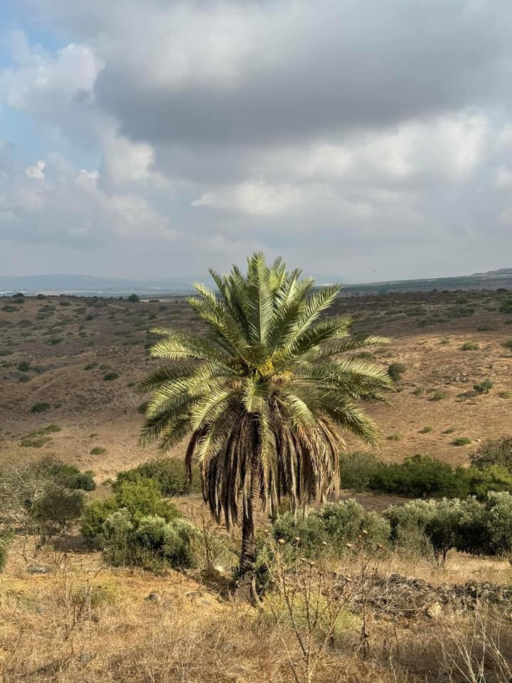
Posted by Uri Zackhem - Palm tree, 'Awlam, 04/10/08

Posted by Uri Zackhem 1 - موقع القريه واثار بيوتها

Posted by abu raya - موقع القريه مغطى بالاعشاب

Posted by abu raya - موقع القريه

Posted by abu raya - بالقرب من القريه

Posted by abu raya - زيتون عولم

Posted by abu raya - الربيع في عولم

Posted by abu raya - موقع القريه واثار ردم بيوتها

Posted by abu raya - Pre-Nakba Aerial view of the village / صورة من الجو للقرية اخذت قبل النكبة
- مشهد عند البير والبركة-- نبيلة سالم

- مشهد عند البير والبركة-- نبيلة سالم #2

- مشهد عند البير والبركة-- نبيلة سالم #3

- As you see the "most civilized" obliterated 'Awlam -- عولم باتت أثر بعد عين. من هنا مر الهمجّ -- سليمان بويرات

- As you see the "most civilized" obliterated 'Awlam -- عولم باتت أثر بعد عين. من هنا مر الهمجّ -- سليمان بويرات #2

- As you see the "most civilized" obliterated 'Awlam -- عولم باتت أثر بعد عين. من هنا مر الهمجّ -- سليمان بويرات #3
- مجموعة من الوثائق التي تخص تعين المعلم عبد الله فرج -- من الناصرة -- في مدرسة سيرين / عولم -- أنقر الصورة لتكبيرها -- 1928 الى 1934

- مجموعة من الوثائق التي تخص تعين المعلم قاسم حميد -- من دللاتة من أعمال صفد -- في مدرسة سيرين / عولم -- أنقر الصورة لتكبيرها -1945 الى 1947

Want to browse more? 80,000 pictures were grouped in these gallaries:
| Display Name | Clan/Hamolah | Country of Residence |
| جواد المغربي | المغربي | - |
| siham qazaq | - | - |
| محمد المغربي | - | اربد, الاردن |
| Maram Moughrabi | المغربي | اربد |
- Tracing all That remains of 'Awlam Since Nakba
- قرية وعين عولم المهجرة في هضبة سيرين Duration: min 33 sec
No links have been shared yet, be free to the first to share the first link.
 Fake Valor: Why Did Zionist Jews Hoist Nazis Flag on Their Ships in the 1930s?
What is new?
-
Facts About Oct. 7th Gaza Raid
-
Remined Us Please: Who Did Rape Whom? Was it Palestinians who raped Israelis? Or, was the other way around? You'll be the judge
-
When Prof. Edward Said was invited to debate Bibi Netanyahu in the 1980s, watch what happened!
-
Ezra Klein of the NY Times on the "Jewish Race".
-
Abusing Blood Libel!
-
How and why Israeli Jewry has become the most hated cult?
-
Did Israeli Soldiers Activate The Hannibal Direective On Oct. 7th? You Be The Judge
-
Zionist FAQ: Isn't it true that Palestinians don't want peace? Palestinians never accepted the two-state solution
- Facts about Haavara (Transfer) Agreement between Ben-Gurion & Hitler
-
Haavara FAQs: Why Did Zionist Jews Hoist Nazis' Flags on Their Ships in the 1930s?
- Haavara FAQs: When Chaim Weizmann met FDR in mid-1943, why was he silent about rescuing European Jewry?
-
Dear ChatGPT: How did Palestinians resist Napoleon's invasion of their country in 1799?
-
Dear ChatGPT: Gaza had a vibrant Jewish community in the mid-17th century. What happened to them?
-
Dear ChatGPT: Why did the Jewish Agency suppress news of the Holocaust during WWII?
-
Video Playlist: Jews share their DNA tests to end the conflict for good.
-
A Tale of Two Conflicts: Examining the Definition of Genocide
-
Prof. Abraham Polak And The Suppressed History of the Khazars and European Jewry
-
How Ronald Reagan would have framed the genocide in Gaza if he were still alive?
-
Haavara FAQs: Let us do the math: how many German Jews did The Haavara Agreement save?
-
Zionist FAQs: The Hebron Massacre of 1929, "clearly proves" that Palestinians are antisemitic, how could you deny it?
-
Zionist FAQs: Why Anti-Zionist Is Not Antisemitism?
-
Zionist FAQs: Isn't it true that the KGB created Palestinian Nationalism in the early 1960s?
- Zionist FAQs: Muslims are killing Muslims all the time; why are Israeli Jews being singled out in the media?
- Zionist FAQs: How is Israel an apartheid state when 20% of its citizens are Arabs who enjoy full rights?
-
Haavara FAQs: Why Did Dorothy Thompson Flip From A Zionist Advocate to A Silenced Dissenter?
-
Haavara FAQs: Analysis of Herzl's Uganda Scheme and how it could have saved millions of Jews.
-
Haavara FAQs: Why did Hayim Greenberg describe American Jewry as "morally bankrupt" in early 1943?
-
Haavara FAQs: What if the Evian Conference was a resounding success? What would have been the impact of saving European Jewry on Zionism?
- Haavara FAQs: What if the six million were saved, how that would have impacted the Zionist project?
-
Haavara FAQs: How did Zionist leaders react when Europe's Jews lingered in the DP camps after WWII ended?
-
Why does the American Jewish community repeat lies that David Ben-Gurion had debunked before he died?
-
Who has the power to rename the Tatar/Khazar Gene Marker to Jewish IV?
-
Zionist FAQs: Why won't Egypt, Syria, and Jordan take their people back? Jews are indigenous to Palestine, and Arabs immigrated after Jews developed the country. Arabs should leave.
-
Haavara FAQs: Did Hitler and the Nazis conflate between Judaism and Zionist? If that wasn't case, then why?
-
Haavara FAQs: Winston Churchill and antisemitism, a collection of articles written Churchill.
-
Haavara FAQs: Broken by country, how many Jews survived vs. killed during the Holocaust?
-
Haavara FAQs: Why did European Jews vote with their feet and to immigrated to the Americas, not Palestine, after WWII?
-
Watch this American Jewish Girl describing Israeli Jews' cognitive dissonance like no other in under two minutes
-
Haavara FAQs: When the Nazis went out of their way to hide the Holocaust, Israeli Jews did the exact opposite by broadcasting their genocide of Gazans. But why?
-
Haavara FAQs: How Zionist Jews went out of their to show their appreciation to Nazism and Fascism?
- Haavara FAQs: Why Zionist leaders were against bombing the death camps & the Railroads leading to them?
-
Haavara FAQs: Hitler's message to the British and American people: If Jews are such noble citizens and you care about them, how come you're not letting them in? I will gladly ship them to you at my expense, even on luxury liners!
-
A shortlist of Zionist and Israeli false flag operations in the name Jews.
-
The Most Moral Army
- The Land of Kapos (Israel): Where the brave are boycotted and Kapos walk free.
- Why did early Zionists often named their communal enterprises "colonial"?
- Zionist Relations with Nazi Germany by Faris Glubb
-
Two NY Times advertisements by Zionists in the early 1943 that exposes Zionists' treason at the height of the calamity
- Facts Not Lies about the Palestinian-Israeli Conflict.
- Site's pictures have been categorized
- Campgain Against Lice
- A Survey of Palestine, the official source about Palestine before Nakba produced by the British Mandate; over 1200 pages.
- Satellite View & Google Earth: Over 6,000 placemarks identifying all destroyed towns, W. Bank & Gaza Strip Towns, & refugee camps.
- PalestineRemembered.com and its Nakba Oral History Project were featured on al-Jazeera Satellite TV.
- Nakba Oral History Video Podcast:
 Over 700 Oral History interviews (including 3,500+ hours of recording) can be viewed online.
 - Palestine Village Statistics Project
- Gaza Jail Break
- النسخة العربية للموقع الان متوفرة
- Videos: Documenting the destroyed villages in video: Tracing all that remains since Nakba.
- Videos: Responding to Zionist Propaganda
- Interview: The ethnic cleansing of Palestine: George Galloway interviews Israeli Historian Ilan Pappe.
- For Palestinians, memory matters. It provides a blueprint for their future By George Bisharat.
- Zionist FAQ now available in Hebrew שאלות שציונים שואלים, עכשיו בעברית
- Video: The Stephen Walt and John Mearsheimer report on the influence of the Israel Lobby on U.S. Foreign Policy
- The Palestinian-Israeli conflict for beginners
